Last updated: December 20, 2024
Article
Park Vital Signs Monitoring: Taking the Pulse of the National Parks

NPS / Lee Richter
Preserving the national parks unimpaired for the enjoyment of future generations is the fundamental purpose of the National Park Service. Park managers across the country are confronted with increasingly complex and challenging issues that require a broad-based understanding of park resources as a basis for making decisions, working with other agencies, and communicating with the public to protect park natural systems and native species.
To provide park managers with the information they need, the National Park Service has embarked on a new era of science-based management. An essential component of this strategy is park vital signs monitoring, a national effort to characterize and determine trends in the condition of park natural resources. When combined with an effective education program, monitoring results can contribute not only to park issues, but also to larger quality-of-life issues that affect surrounding communities and can contribute significantly to the environmental health of the nation.
The network is the best source of information and assistance that parks receive when developing natural resource management plans and identifying management goals.

NPS
Park Vital Signs
Park vital signs are selected physical, chemical, and biological elements and processes of park ecosystems that represent the overall health or condition of park resources, known or hypothesized effects of stressors, or elements that have important human values.
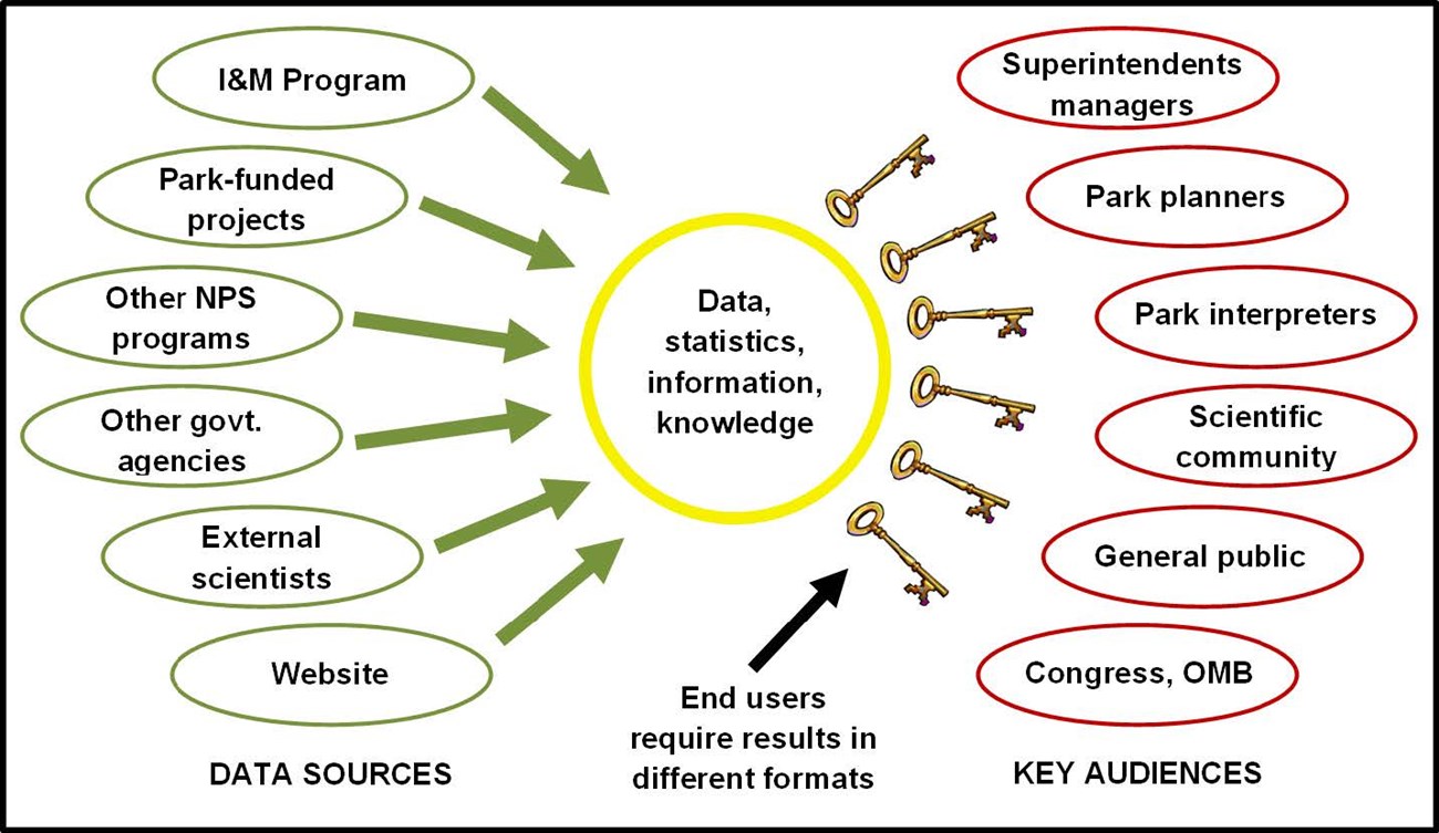
The vital signs monitoring component of the National Park Service Inventory and Monitoring Program (I&M) provides park managers, planners, and other key audiences with scientifically credible data and information on the status and trends of selected park resources. This information is used as a basis for making decisions and working with other agencies and the public for the long-term protection of park ecosystems.
The monitoring program is designed to provide site-specific information needed to understand and identify change in park ecosystems that are characterized by complexity, variability, and surprises, and to help determine whether observed changes are within natural levels of variability, or if they may be the result of unwanted human influences. The broad-based, scientifically sound results obtained through this systems-based, long-term ecological monitoring program have multiple applications for management decisionmaking, research, education, and promoting public understanding of park resources.
The network has taken on our most important monitoring goals and provided a sustainable, quality controlled approach to ensuring that we will have consistent, reliable information.
Program Details

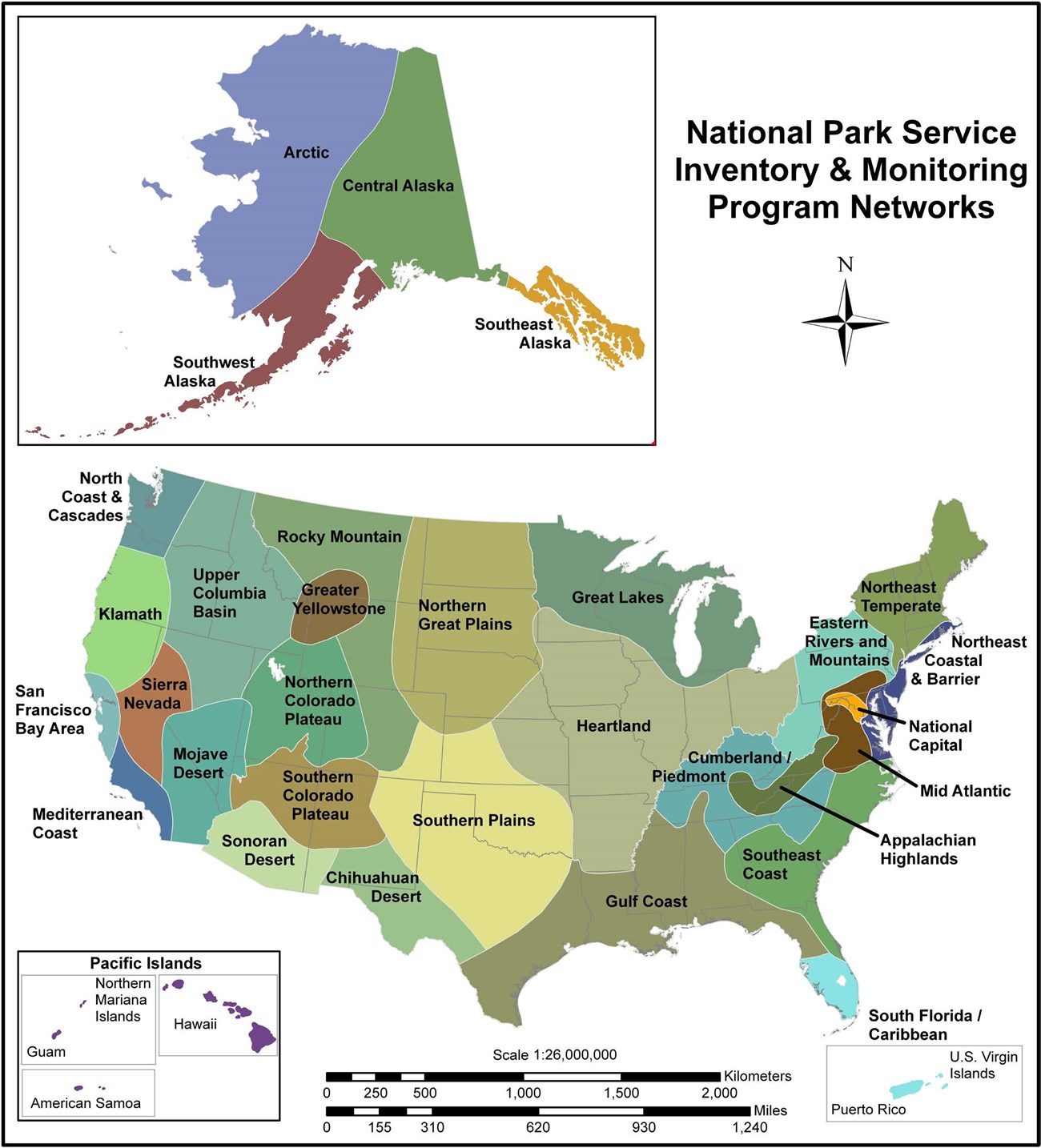
Under the I&M Program, more than 300 park units with significant natural resources have been organized into 32 I&M networks. Each network links parks that share similar geographic and natural resource characteristics to improve efficiency and reduce costs. Networks facilitate basic inventories, conduct long-term resource monitoring for priority resources, and effectively deliver scientific data and information to key audiences.
Parks within a network share funding and professional staff to avoid duplication of efforts. Because of funding and travel restrictions, only the highest priority vital signs, or those that are already funded by some other source, can be monitored initially. Three key aspects of the I&M strategy are the leveraging of resources and expertise through integration and collaboration with other NPS programs and agencies; an interdisciplinary approach to compiling, analyzing, and reporting natural resource information; and an explicit link to park management and planning.

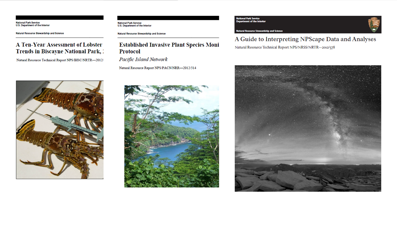
The 32 I&M networks have become a significant component of the overall scientific and information management infrastructure and expertise of the NPS. Network personnel are involved in numerous activities and functions such as organizing and cataloging data; performing data analysis, synthesis, and modeling; and providing data and expertise to park planners. Network personnel also provide data and expertise for Natural Resource Condition Assessments, Resource Stewardship Strategies, and State of the Park reports. The I&M networks have become known as a key source and provider of reliable, organized, and retrievable information about parks that otherwise might be unavailable, misplaced, or lost to managers and others who needed it for sound decisions and sound science.

