Part of a series of articles titled A Stewardship of Storytelling.
Article
"Valles Caldera - Setting the Scene" by Melissa Fu

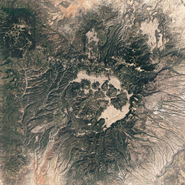
Courtesy of the International Space Station
All that being said, it’s been a minute, well 50,000 years to be more precise, since the last eruptions up here. The El Cajete eruptive series were relatively small compared to the early blasts that formed this area. Known as “The Southwest’s Youngest Caldera,” Valles Caldera started with a massive eruption about 1.2 million years ago. The initial single vent of the blast evolved into a ring fracture vent system that eventually collapsed in on itself, leaving a crater 16 km in diameter. With time, this crater filled with water and over the next 50,000 years, a resurgent dome rose from in the middle of the lake. That dome is now called Redondo Peak, the highest point in Valles Caldera.
Following Redondo Peak, smaller lava domes popped up along the old ring fracture in an anticlockwise sequence during the subsequent 1.2 million years. These are the “cerros,” which means “hill” in Spanish: Cerro del Medio, Cerro del Abrigo, Cerros de Trasquilar, Cerro San Luis, and Cerro Seco. The excess freshwater drained over the edges of the crater, cutting through layers of volcanic ash (all that debris had to go somewhere), thus creating the canyons and mesas of the surrounding area.

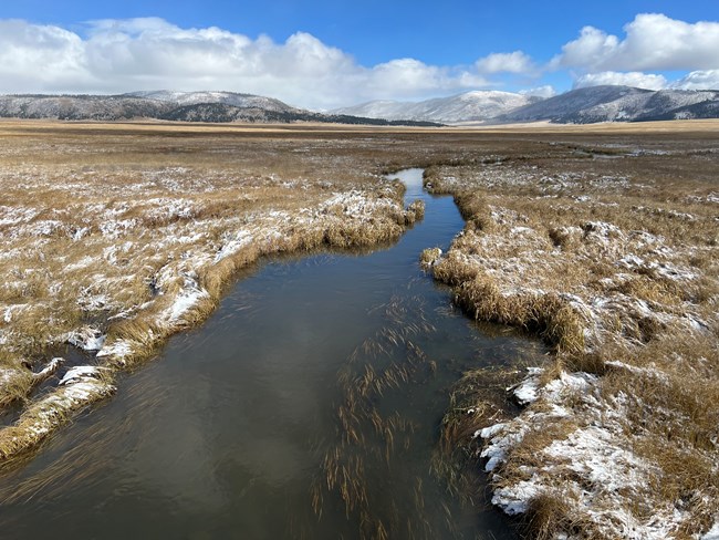
NPS/Dave Krueger
That’s the broad outline. There’s much more fascinating geology and nuance to this story, and as I walk these trails and climb these mountains over the coming weeks, I hope to add more detail. But because Valles Caldera is like nowhere else I know, I wanted to set the scene, to give you a sense of just how old and magnificent – and changeable – these hills and valleys are.
Last updated: December 9, 2024
