Plan Your Visit

Welcome to Chiricahua National Monument!

Chiricahua National Monument is truly a hidden gem just 45 minutes south of I10.

Explore rhyolite pinnacles and balanced rocks on foot or by car. Relax at the campground under star-filled, dark skies. See how a mountain range rising between two deserts creates a home for diverse wildlife. Imagine history here. Prehistoric peoples, Apaches, Buffalo Soldiers, Civilian Conservation Corps, ranchers, and homesteaders inhabited Chiricahua.

 
A map of southeast Arizona
How to Get Here...

Stay on the pavement for an easy drive or take a more adventurous route.

A hiker watches the sunset from a scenic overlook
Things To Do

Find out about hiking, the scenic drive, picnicing, camping, horseback riding, birding or watching wildlife.

Hikers on a trail
Hiking

Chiricahua offers a range of day hiking options from easy to strenuous.

A ranger points out rock formations to a group of visitors.
Guided Tours and Programs

Join a park ranger or park volunteer to learn more about the park

Mist covered rock formations in the winter
Current Conditions

Check out the current conditions, weather, and climate throughout Chiricahua
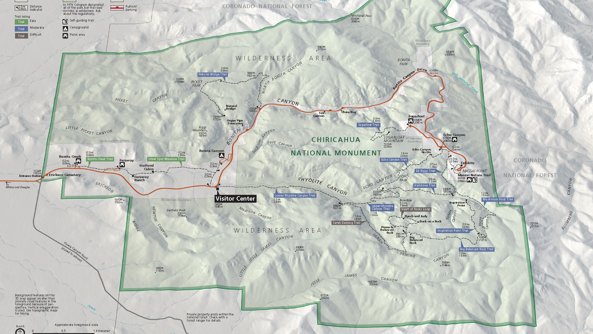
map of the park
Maps

Maps to help you find your way and plan your trip to Chiricahua

campsite with pines trees and tent
Campground by Reservation Only

This small, historic campground with mature trees can accommodate small vehicles and tents.

a paved road and roadside rock formations
Travel Tips

Travel and safety tips to consider when planning your trip to Chiricahua

Last updated: January 10, 2025

Park footer

Contact Info

Mailing Address:

12856 E Rhyolite Creek Rd
Willcox, AZ 85643

Phone:

520 824-3560
The visitor center phone is staffed from 8:30 am to 4:30 pm daily. If we don't answer we may be helping others. Please leave a message with your phone number. We do not have caller ID. If calling while driving nearby, please pull over as cell reception will likely cut out.

Contact Us