
*Please be aware that the Ponderosa Loop, Petrified Forest loop, and Geologic trail are closed from 4:30pm until 9am. Download the hiking trails map 
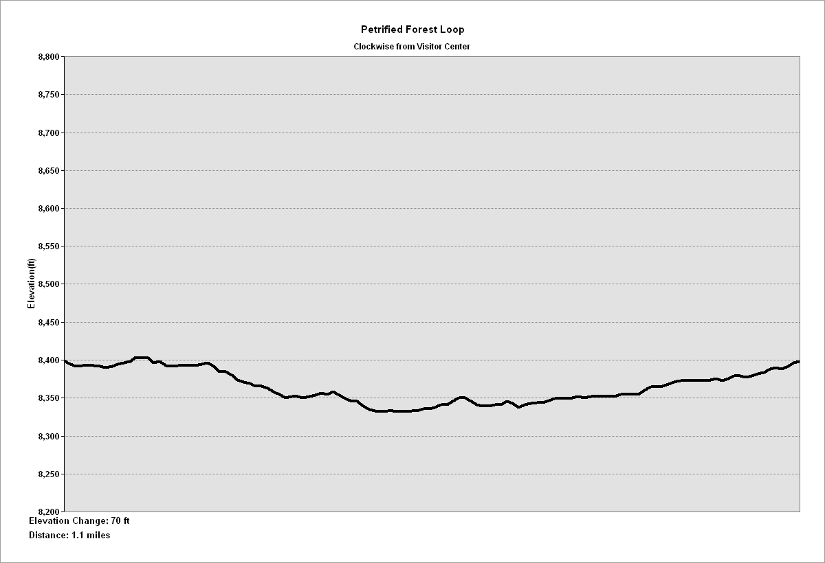
NPS Photo/Peterson Petrified Forest Loop - 1.1 mile This self-guided trail leads through the beds of ancient Lake Florissant. It passes numerous giant petrified redwood tree stumps, including the colorful "Big Stump". This trail starts behind the outdoor exhibit area. EASY Elevation Change: 70 ft. Trail Profile

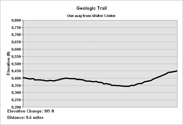
NPS Photo/Peterson Geologic Trail - 0.6 mile (one way) This self-guided trail highlights over a billion years of geologic history in the Florissant Valley. It passes over the ancient lake bed, crosses Teller County Rd. 1, then ascends past the remnants of a massive pyroclastic flow and ends at a scenic overview of the Florissant valley. From the visitor center, follow the Petrified Forest Loop to the junction of the Hornbek Wildlife Trail. MODERATE Elevation change: 105 ft. Trail Profile 
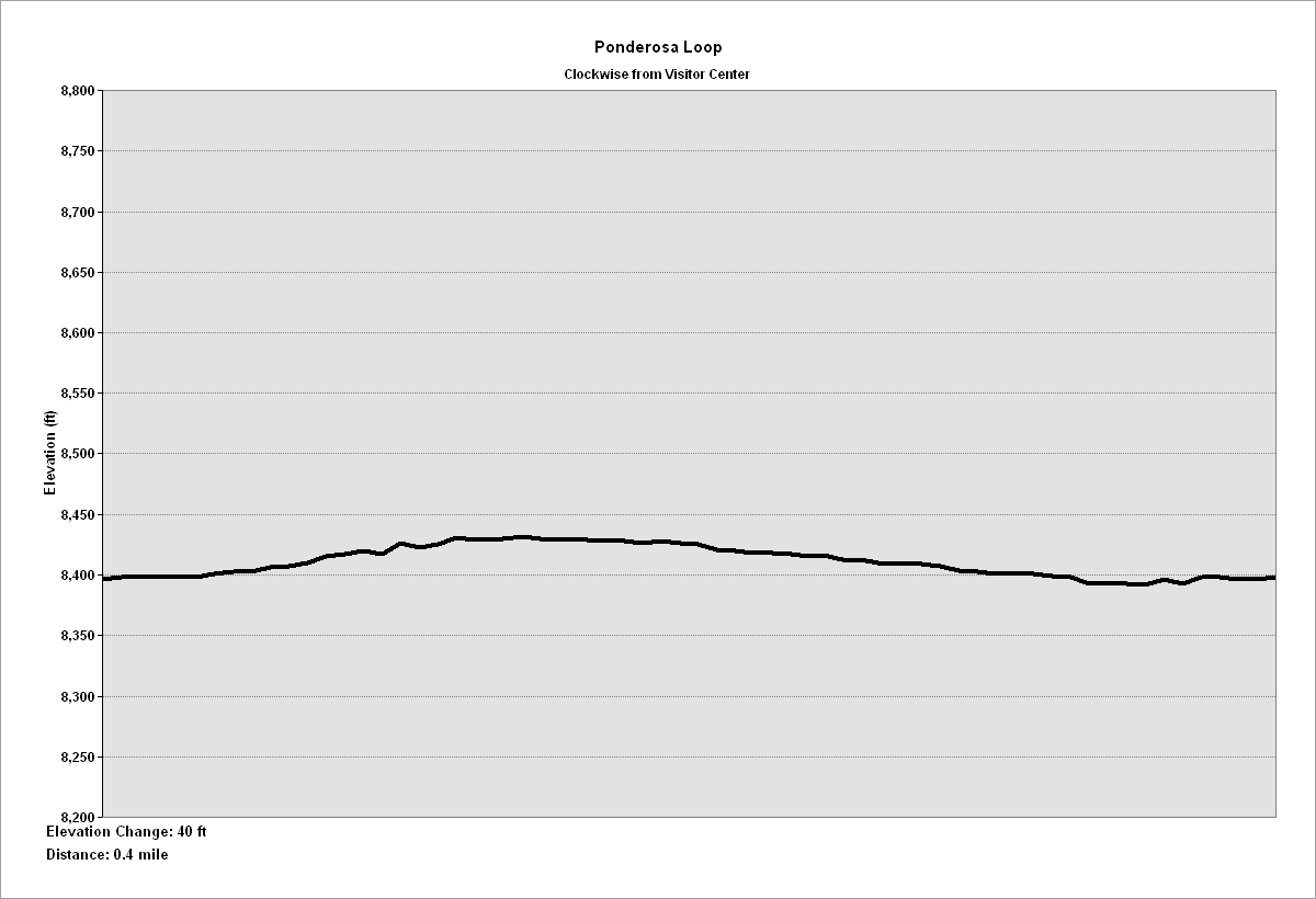
NPS Photo/Peterson Ponderosa Loop - 0.4 mile This wheelchair accessible trail starts behind the exhibit area. This self-guided trail enters the modern forest of ponderosa pines, aspen, douglas fir, and spruce trees. EASY - Elevation change: 40 ft. Trail Profile 
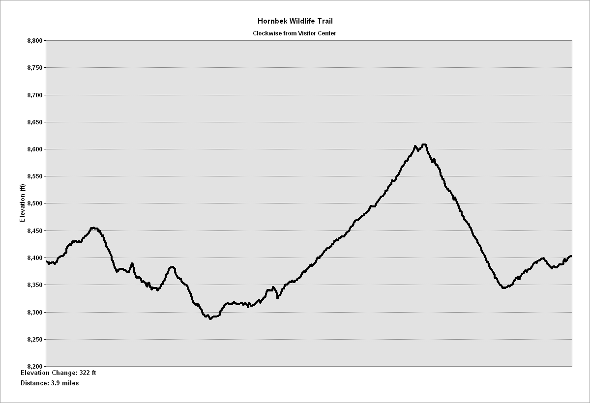
NPS Photo/Peterson Hornbek Trail - 3.9 miles Following meadows, the trail to Hornbek Homestead crosses land once covered by ancient Lake Florissant. The return route overlooks the ancient lake and the mountain ranges beyond. Signs of wildlife are common. MODERATE Elevation change: 322 ft. Trail Profile 
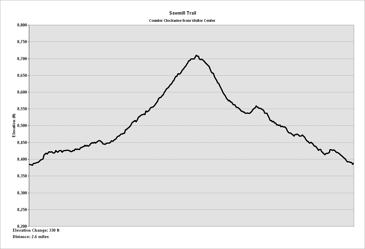
NPS Photo/Peterson Sawmill Trail - 2.6 miles 
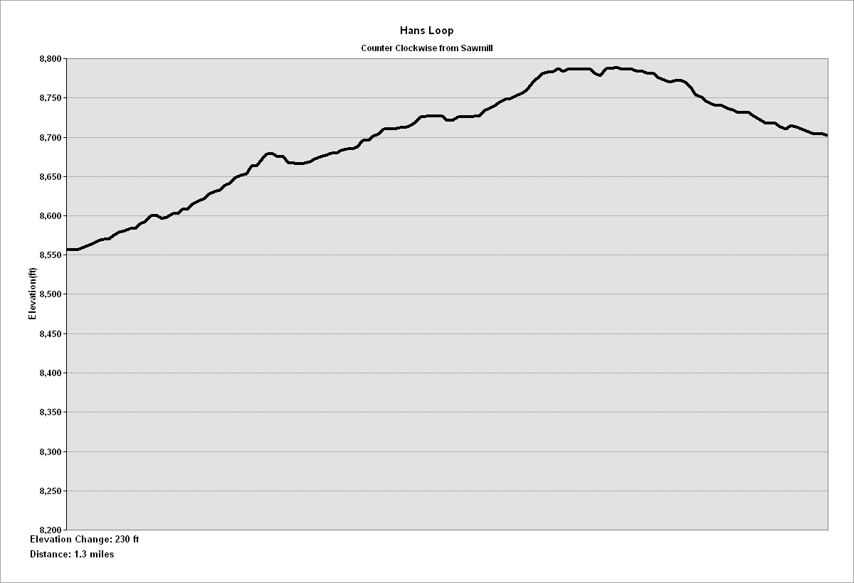
NPS Photo/Peterson The Hans Loop trail is an extension of the Sawmill Trail. Part of the trail follows a gentle ridge that provides vistas of Pikes Peak. MODERATE Elevation change: 230 ft. Trail Profile 
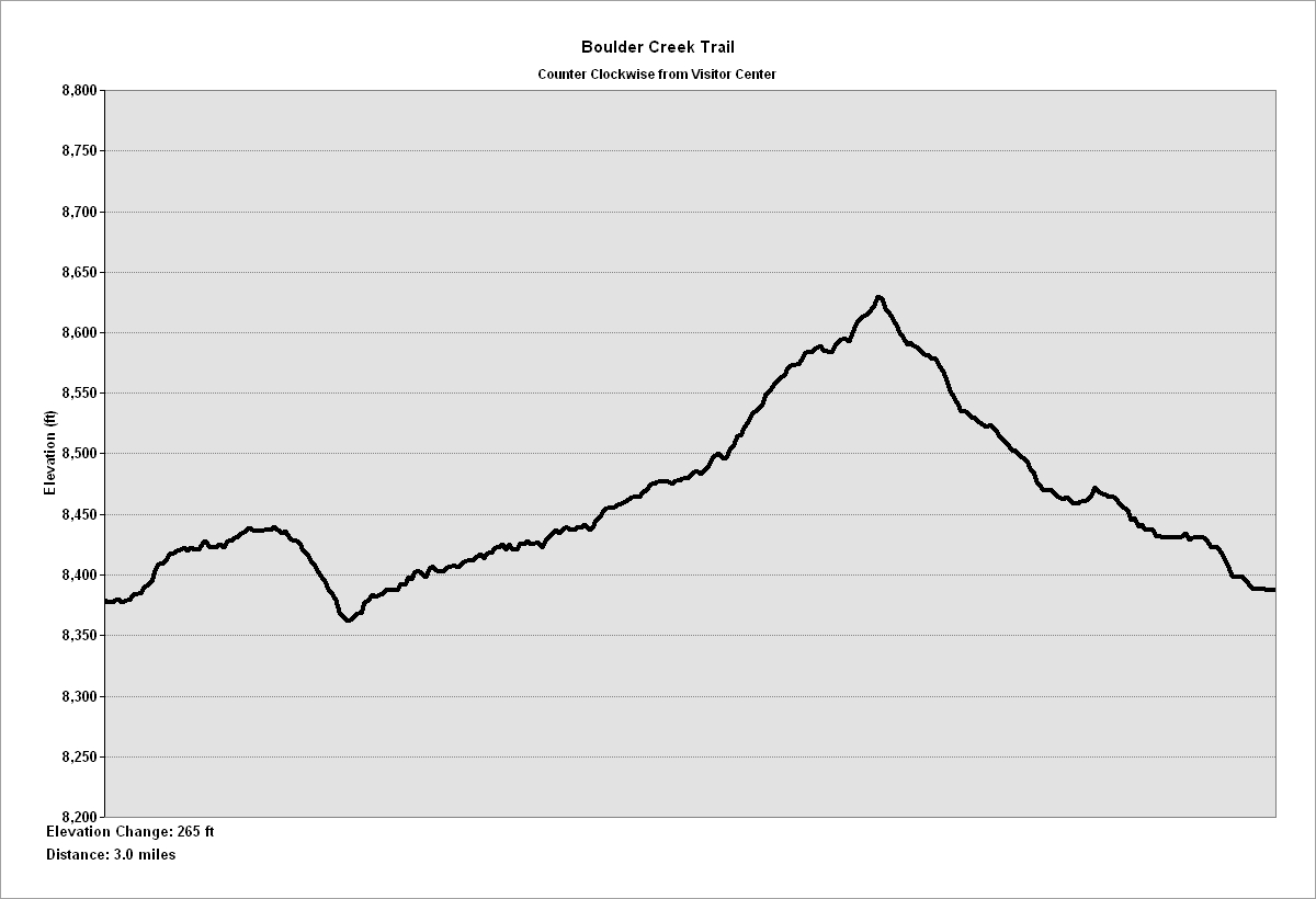
NPS Photo/ Peterson Boulder Creek Trail - 3.0 miles This loop trail begins and ends in the ponderosa pine forest, but crosses diverse ecosystems. A portion of the trail skirts wet meadows, crosses a stream, and passes a formation of giant eroded granite boulders. MODERATE Elevation change: 265 ft. Trail Profile 
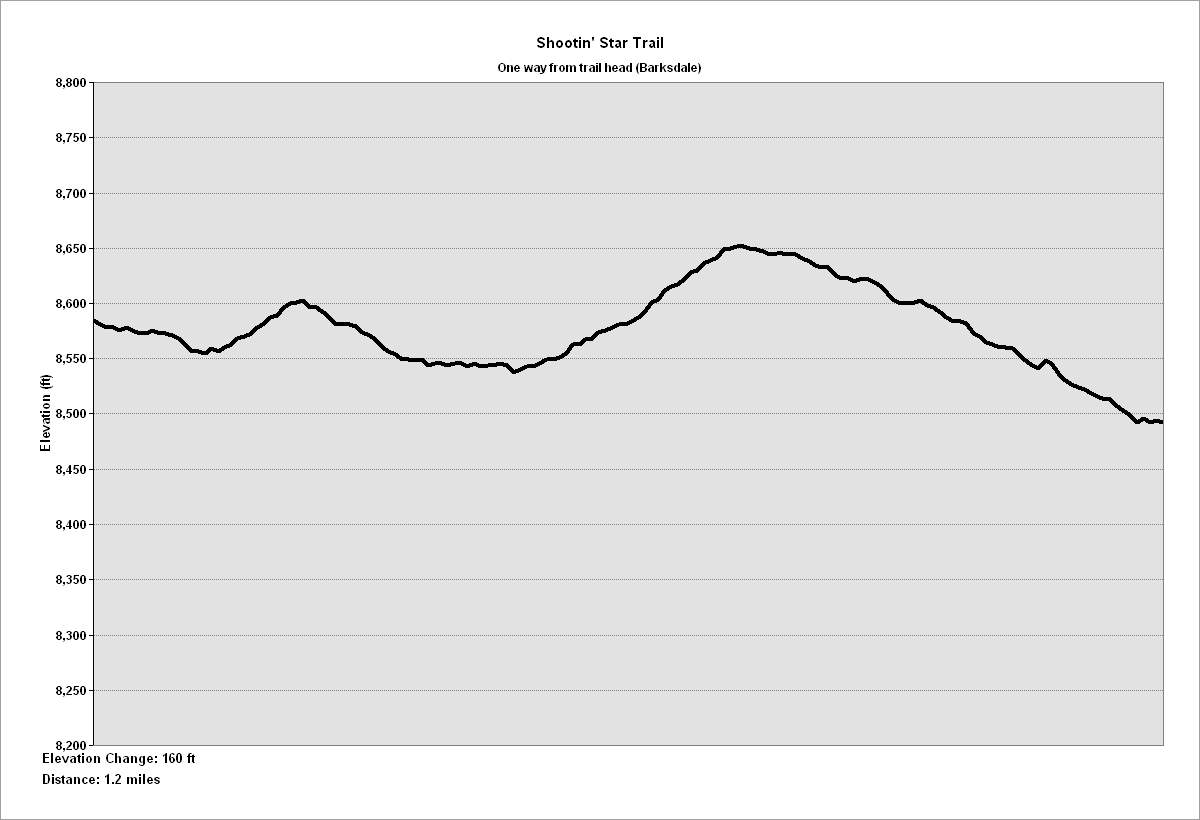
NPS Photo/Peterson Shootin' Star Trail - 1.3 miles (one way) Starting at the Barksdale Picnic area, this trail crosses a stream, follows an old roadbed, and traverses meadows to travel through the ponderosa pine forest. The trail gets its name from a historic ranch. Look for signs of former agricultural activity. MODERATE Elevation change: 160 ft. Trail Profile 
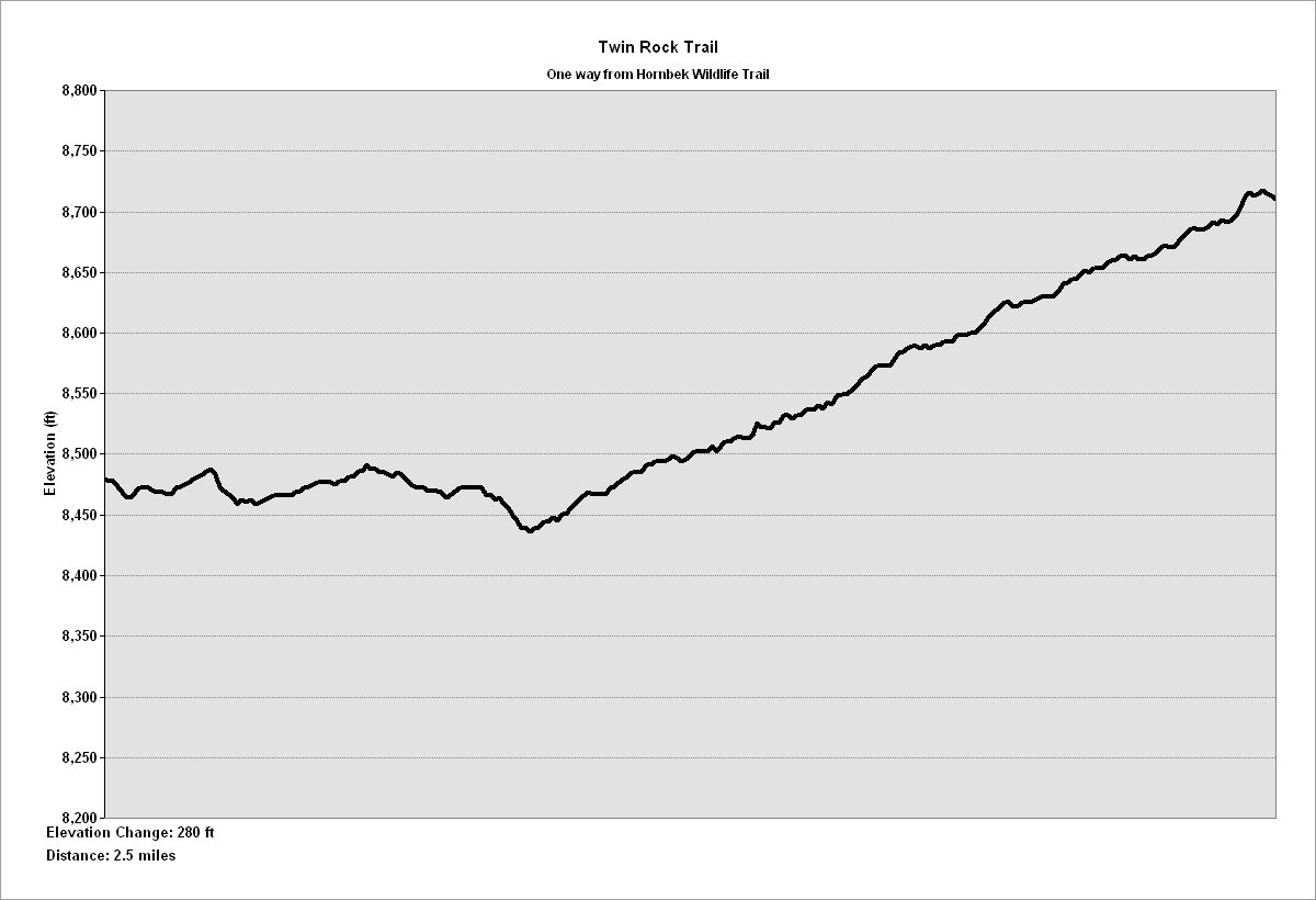
NPS Photo/Peterson Twin Rock Trail - 2.5 miles (one way) This trail is accessed from the Shootin' Star Trail or the Hornbek Trail. The trail features quiet views of rock formations, open meadows, aspen groves, riparian habitats, willows, and pond life. Signs of wildlife are common. MODERATE Elevation Change: 280 ft. Trail Profile To learn more about activities at the Monument, explore Things to Do. |
Last updated: February 3, 2025