Last updated: March 18, 2025
Place
Agat Unit - Apaca Point and Ga'an Point
War in the Pacific National Historical Park
Quick Facts
Location:
9MP5+Q75, Hågat, Guam
Significance:
Park unit commemorating the southern landing beach during the Battle of Guam
Amenities
10 listed
Beach/Water Access, Benches/Seating, Grill, Historical/Interpretive Information/Exhibits, Parking - Auto, Pets Allowed, Picnic Shelter/Pavilion, Picnic Table, Restroom, Scenic View/Photo Spot
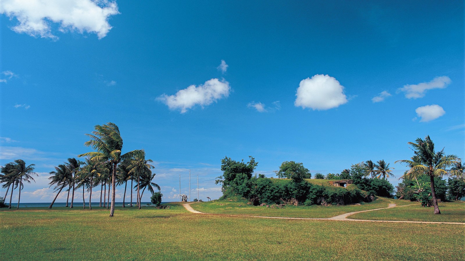
Hågat (Agat) Beach was the southern landing beaches used during the Battle of Guam. Stretching from Bangi Point in the south to Apaca Point in the north, Hågat Beach was chosen to help secure Orote Peninsula to the north—home to a strategic airfield and the entrance to Apra Harbor.
On July 21, 1944, the United State's goal was to overtake Ga'an Point, a coral outcrop at the center of Hågat Beach, then use the entire beachfront to offload supplies and equipment. The rocky outcrops along the beach had been well fortified, however. In the months leading up to battle, Imperial Japanese defenders forced the CHamoru to blast caves and build bunkers directly into the limestone headland. With gunports for eyes and rocky ridges for armor, Japanese soldiers turned the terrain itself into a deadly defense.
Today, the remains of those fortifications, as well as two examples of Imperial Japanese guns, stand against a backdrop of clear blue ocean.
The Agat Unit consists of two separate locations: Ga'an Point and Apaca Point, which are approximately 1.3 miles apart and not connected by any trail.
Learn more about how to visit and what to do at the Agat Unit.