Last updated: December 30, 2021
Place
Camp Disappointment
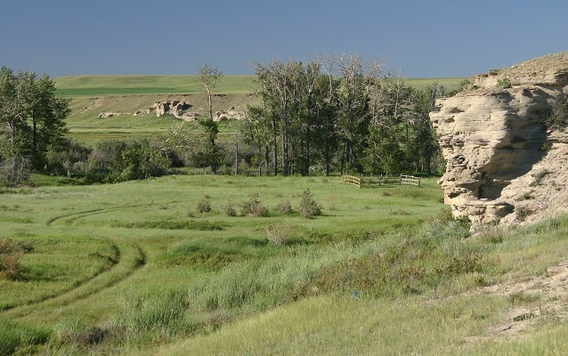
Photo by Roger Deschner
Quick Facts
Location:
Near Browning, MT
Significance:
Northernmost campsite of Expedition
Designation:
National Register of Historic Places, National Historic Landmark
MANAGED BY:
Lewis and Clark NHT Visitor Centers and Museums
This map shows a range of features associated with the Lewis and Clark National Historic Trail, which commemorates the 1803-1806 Lewis and Clark Expedition. The trail spans a large portion of the North American continent, from the Ohio River in Pittsburgh, Pennsylvania, to the mouth of the Columbia River in Oregon and Washington. The trail is comprised of the historic route of the Lewis and Clark Expedition, an auto tour route, high potential historic sites (shown in black), visitor centers (shown in orange), and pivotal places (shown in green). These features can be selected on the map to reveal additional information. Also shown is a base map displaying state boundaries, cities, rivers, and highways. The map conveys how a significant area of the North American continent was traversed by the Lewis and Clark Expedition and indicates the many places where visitors can learn about their journey and experience the landscape through which they traveled.
Camp Disappointment is a High Potential Historic Site on the Lewis and Clark National Historic Trail.
During the return journey, Lewis decided to explore up to the headwaters of the Marias River in order to determine if it extended north of the 49th Parallel (thereby expanding the northern boundary of the Louisiana Purchase), and discover if there was an easy portage between the Marias and Saskatchewan rivers (which could route western Canadian fur trade to the Missouri). Lewis, Drouillard and the two Field brothers reached the expedition’s northernmost campsite on July 22, 1806, and spent three full days exploring the area. With observation efforts frustrated by continual bad weather and increasingly wary of encountering hostile Blackfeet, they departed on the morning of July 26. After failing to establish a latitude with his instruments, coupled with an understanding that the Marias River did not reach as north as hoped, Lewis wrote, “we set out biding a lasting adieu to this place which I now call camp disappointment.”
Camp Disappointment lies within an open landscape of meadows interspersed with cottonwood stands along Cut Bank Creek. To the immediate east of the campsite and abutting the creek is a distinctive 300- foot cliff that was traditionally used as a buffalo jump. Located on privately owned land within the Blackfeet Indian Reservation, permission is needed to access this site. In 1925, the Great Northern Railroad erected a monument to commemorate Camp Disappointment near milepost 233 on US Highway 2. It is about four miles south of the actual historic site.