Last updated: December 30, 2021
Place
Sugar Loaf Rock

Lewis and Clark NHT Visitor Centers and Museums
This map shows a range of features associated with the Lewis and Clark National Historic Trail, which commemorates the 1803-1806 Lewis and Clark Expedition. The trail spans a large portion of the North American continent, from the Ohio River in Pittsburgh, Pennsylvania, to the mouth of the Columbia River in Oregon. The trail is comprised of the historic route of the Lewis and Clark Expedition, an auto tour route, high potential historic sites (shown in black), visitor centers (shown in orange), and pivotal places (shown in green). These features can be selected on the map to reveal additional information. Also shown is a base map displaying state boundaries, cities, rivers, and highways. The map conveys how a significant area of the North American continent was traversed by the Lewis and Clark Expedition and indicates the many places where visitors can learn about their journey and experience the landscape through which they traveled.
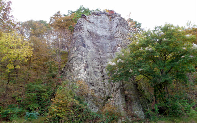
Clark wrote on June 4, 1804, that he “assended a hill of about 170 foot to a place where the french report that Lead ore has been found, I saw no mineral of that description, Capt Lewis Camped imediately under this hill, to wate which gave me Some time to examine the hill, on the top is a moun of about 6 foot high and about 100 Acres of land which the large timber is Dead in Decending about 50 foot a projecting lime Stone rock under which is a Cave at one place in this projecting rocks I went on one which Spured up and hung over the Water from the top of this rock I had a prospect of the river for 20 or 30 ms. up, from the Cave which incumposed [encompassed] the hill I decended by a Steep decent to the foot…” In 1833, Prince Maximilian of Wied-Neuwied visited the same location and noted, “On a wooded eminence, on the left hand, at some distance from the bank, is a high, isolated rock, which stands like a tower in the forest… some Joway Indians, was told by them, that there was a tradition among their ancestors, that this rock was formed of the dung of a race of bisons, which lived in heaven, but they themselves no longer believed this fable.”
Although Sugar Loaf Rock historically abutted the Missouri River, the channel has since shifted nearly a mile to the north. It is difficult to view the landmark, as it is privately-owned and not visible from the river. The expanse of bottomland below Sugar Loaf Rock is the property of the Central Missouri Correctional Center, which restricts public access. The hilltop mound described by Clark remains extant, and the summit of Sugar Loaf Rock overlooks a sweeping vista of the river valley.
