
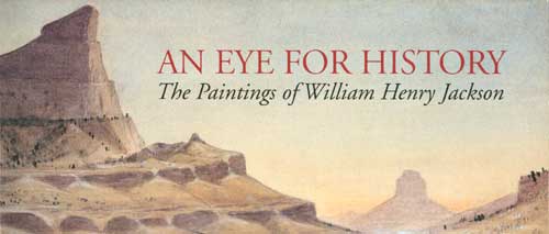
INTRODUCTION
By Marian Albright Schenk
FOREWORD
By Dean Knudsen
SECTION 1
Primary Themes of Jackson's Art
SECTION 2
Paintings of the Oregon Trail
SECTION 3
Historic Scenes From the West
 |
| An enigmatic note on the back of this photograph reads, "Honey, pleases have my PB (pinched-back?) suit pressed and ink taken out." This image probably dates from around 1910. (SCBL 2637) |
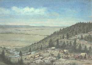
Section 2: Paintings of the Oregon Trail
THE OREGON TRAIL
After separating from the California and Mormon Trails in western Wyoming, the Oregon Trail veered to the northwest across Idaho toward Fort Hall. Even then, there really wasn't any "One" Oregon Trail. Rather, the Oregon Trail consisted of a network of shortcuts and cutoffs that were used at various times and with varying degrees of success.
For example, while still in Wyoming, emigrants had the option of following what was known as the Lander Road or Cutoff East of South Pass, this trail struck off to the northwest to Fort Hall. If they had continued on the trail past South Pass, the emigrants again had a decision to make. In this case there was the option of taking the Sublette Cutoff which sought to save many miles. It eventually joined up with the main route of the Oregon Trail, which jogged south to Fort Bridger before swinging back to the northwest into Idaho. This part of the trail was referred to as the Bear River Divide.
It was the wagon master's decision to use the Bear River Cutoff and by-pass Salt Lake City that caused William Henry Jackson to quit his job with the freight wagons and make his way to Utah. If Jackson had continued on the Oregon Trail, he would have come to Soda Springs, which is where the trail branched again—this time to the west. This route was taken by many people bound for California. Farther along on the Oregon Trail, the road branched off to the north, and this is the route Jackson's wagon would have taken into western Montana.
 |
| A notation in Jackson's handwriting reads, "From the Blue Mountains to the Valley of the Columbia in Oregon. Ideal composition by W.H. Jackson." (SCBL 44) |
One of the most unique and dramatic crossings of any river along the Oregon Trail took place in south central Idaho. Although river crossings were avoided unless there no other alternative, fording the Snake River at this point offered emigrants a difficult choice. They could remain safely on the south bank of the river until they were about ten miles west of Fort Boise, however, the trail on the north bank offered easy access to fresh water and a less difficult roadbed.
Oftentimes the choice would depend on the water level of the river, for while nature provided some small islands to serve as stepping stones for the wagon trains, the final channel was fairly deep and the current could be very swift. In high water the crossing could be very dangerous, and there are stories of several accidents that took place here.
An 1845 account by Samuel Hancock describes the risky procedures that were used at Three Island Crossing:
We now made preparations for crossing the river, which was very rapid and deep, and perhaps 200 yards wide; the crossing was affected by propping up the wagon beds above the reach of the water and having three men on horseback by the team of the first wagon, to which the others were all chained to the preceding one, and with a man on horseback to keep the teams straight, we reached the opposite bank safely. . .1
Eventually these two branches of the Oregon Trail came together again near Fort Boise, which was located near the border of present-day Oregon. Although the emigrants had covered 1500 miles to this point, some of the most difficult terrain was in the 400 miles still ahead of them.
1. Samuel Hancock, Samuel Hancock 1845-1860, (New York City: R.M. McBride & Co., 1927), 26.
 |
| Three Island Crossing. Signed and undated. 23.5 x 35.8 cm. (SCBL 43) |
 |
scbl/knudsen/sec2u.htm Last Updated: 14-Apr-2006 |
 |