NPS image.
Geology and Stratigraphy of the Appalachian Highlands I&M Network Parks
The Appalachian Highlands Inventory and Monitoring Network (APHN) consists of four national park areas in Kentucky, North Carolina, Tennessee, and Virginia including: Big South Fork National River and Recreation Area, Blue Ridge Parkway, Great Smoky Mountains National Park, and Obed Wild and Scenic River. The network parks are divided between two ecologically distinct physiographic regions: the Cumberland Plateau of Kentucky and Tennessee, and the Southern Appalachian Mountains of Georgia, North Carolina, Tennessee, and Virginia. Both these regions are characterized by high levels of biological diversity and endemism (Santucci et al. 2008).
The Appalachian Mountains are one of the oldest mountain ranges in the world. The long stability of the Appalachian Mountains, combined with its great variation in geology, landforms, and climate, have supported the evolution of a rich diversity of fauna and flora, especially in the southern regions which were not directly impacted by glacial activity. Within the Southern Appalachians, the Blue Ridge Mountains (Blue Ridge Province ) rise abruptly above the rolling Piedmont to the east and form the backbone of the Appalachians in this region. The Southern Appalachians ecoregion is one of the most biologically diverse terrestrial ecosystems in the world.
To the west of the Blue Ridge Mountains are the Valley and Ridge Province and the Cumberland Plateau. The Valley and Ridge Province consists of folded and unmetamorphosed Paleozoic sedimentary rocks that include sandstones, shales, and limestones, with some Pennsylvanian-age coal beds (see geologic time scale). These sedimentary units are underlain by large thrust faults generated by intercontinental collisions during the late Paleozoic. The Cumberland Plateau is an extensive tableland of sandstone and shale carved by water into a labyrinth of rocky ridges and deep gorges. The Cumberland River system includes the Big South Fork and Obed rivers.
A Brief Geologic History
A few examples of events and Network resources in each geologic time period are highlighted below, from youngest to oldest.
With the exception of Quaternary surficial deposits, the only Cenozoic strata in the APHN network parks is an unknown unit which may date between Pleistocene to as old as Miocene in age in Great Smoky Mountains National Park (Thornberry-Ehrlich 2008).
The Mesozoic is not well represented in the APHN parks. The only Mesozoic rocks are Jurassic diabase mapped in narrow dikes that intrude older geologic units in BLRI. Diabase is exposed just south of Roanoke River near MP 118 and MP 125, north of James River near MP 56, and in the vicinity of Afton near MP 3 and north of MP 0 (Carter et al. 2016).
The Appalachian Mountains were significantly uplifted and deformed during the Paleozoic due to a series of orogenies that include the Taconic Orogeny (475–405 million years ago), Acadian Orogeny (390–350 million years ago), and Alleghenian Orogeny (300–245 million years ago). Paleozoic rocks occur in all four of the Appalachian Highlands Network parks. The Cambrian is represented by seven units in BLRI and seven units in GRSM. The only Cambrian unit to occur in both parks is the Shady Dolomite. Lower and Middle Ordovician units (Jonesboro Limestone and Chickamauga Group) are mapped in GRSM. The only Devonian formation occurring in any of the Appalachian Highlands Network parks is the Chattanooga Shale, which is present in Great Smoky Mountains.
The Upper Mississippian is most extensively exposed at BISO in the form of a sandstone belt of cliffs and steep-sided, narrow-crested valleys. Terrestrial Mississippian sandstones and siltstones are the result of a great influx of mud, silts, and sands brought in by rivers and streams from uplands many miles to the northeast and deposited as a great delta. The Mississippian limestones of the region were deposited 350 million years ago in the bottom of a warm, shallow sea. Mississippian rocks also occur in limited exposures in Great Smoky Mountains.
At the end of the Mississippian (approximately 320 million years ago) the seas receded and were overlain by Pennsylvanian-aged sediments. The warm climate of the Pennsylvanian allowed 5 extensive forests to grow and great coastal swamps to develop at the edges of water bodies. Marine waters advanced and receded many times, which produced many layers of sandstone, shale, and coal. Pennsylvanian-age plants were buried under blankets of sediments, which over long geologic time were compressed into coal.
At Big South Fork the Pennsylvanian rocks are predominantly sandstone and shale, and include siltstone, conglomerate, and coal. A dendritic drainage pattern resulted in narrow and V-shaped gorges. The weathering processes on these rocks have produced an impressive array of geologic features, including arches, mesas, chimneys, cracks, and rock shelters. Lower and Middle Pennsylvanian units, including sandstone, shale, conglomerate and coal, dominate the bedrock at Obed Wild & Scenic River and large portions of Big South Fork.
Precambrian geology is well represented at Blue Ridge Parkway and Great Smoky Mountains. The oldest rocks in the network are igneous and metamorphic units which date to the Mesoproterozoic. At least seven Neoproterozoic units are mapped at Blue Ridge Parkway and 16 Neoproterozoic units are documented in Great Smoky Mountains. The Blue Ridge Province and Mountains represent the backbone of the central and southern Appalachians and have an important geologic history during the Precambrian. The Blue Ridge Mountains were significantly influenced by multiple mountain-building events (orogenies), beginning with the Grenville Orogeny that occurred approximately 1.1 billion years ago.
Geology & Soils—Appalachian Highlands Network Parks
Type Sections—Appalachian Highlands Network

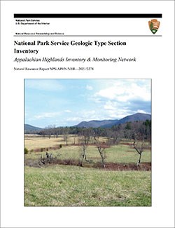
The geologic history above is excerpted from a report titled, "National Park Service geologic type section inventory: Appalachian Highlands Inventory & Monitoring Network". Type sections are essential reference locations for the geoscientists who study geologic history and paleontology. A summary of the type sections in each park can be found at the links below.
-
Big South Fork National River and National Recreation Area, Kentucky and Tennessee (no designated stratotypes identified)
-
Blue Ridge Parkway, North Carolina and Virginia (contains one identified stratotype)
-
Great Smoky Mountains National Park, Tennessee and North Carolina (contains nine identified stratotypes)
-
Obed Wild and Scenic River, Tennessee (no designated stratotypes identified)
The full Network report is available in digital format from:
Please cite this publication as:
-
Henderson T, Santucci VL, Connors T, Tweet JS. 2021. National Park Service geologic type section inventory: Appalachian Highlands Inventory & Monitoring Network. Natural Resource Report. NPS/APHN/NRR—2021/2278. National Park Service. Fort Collins, Colorado.
NPS Stratotype Inventory
Fossil Resources—Appalachian Highlands Network

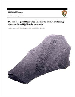
Between 2002 and 2011, network-based paleontological resource inventories were completed for all the 32 I&M networks, and six of the earliest were completely updated between 2012 and 2016. The report linked below summarizes the paleontological resources of all park units in the Appalachian Highlands Inventory & Monitoring Network (APHN). The report provides geologic background and paleontological resource data for each park to support management operations, planning, and science-based decision making as required by NPS management policies and the Paleontological Resources Preservation Act (2009).
The full report is available in digital format from
-
DataStore - Paleontological Resource Inventory and Monitoring—Appalachian Highlands Network (nps.gov)
Please cite this publication as:
-
V. L. Santucci, R. T. P. McKenna, J. P. Kenworthy, and T. Connors. 2008. Paleontological Resource Inventory and Monitoring—Appalachian Highlands Network. Natural Resource Technical Report NPS/NRPC/NRTR—2008/080. National Park Service, Fort Collins, Colorado.
Geodiversity Atlas pages—by Inventory & Monitoring Network
Arctic Network Index
Central Alaska Network Index
Chihuahuan Desert Network Index
Cumberland Piedmont Network Index
Eastern Rivers and Mountains Network Index
Great Lakes Network Index
Greater Yellowstone Network Index
Gulf Coast Network Index
Heartland Network Index
Klamath Network Index
Mediterranean Coast Network Index
Mid-Atlantic Network Index
Mojave Desert Network Index
National Capital Network Index
North Coast and Cascades Network Index
Northeast Coastal and Barrier Network Index
Northeast Temperate Network Index
Northern Colorado Plateau Network Index
Northern Great Plains Network Index
Pacific Islands Network Index
Rocky Mountain Network Index
San Francisco Bay Area Network Index
Sierra Nevada Network Index
Sonoran Desert Network Index
South Florida/Caribbean Network Index
Southeast Alaska Network Index
Southeast Coast Network Index
Southern Colorado Plateau Network Index
Southern Plains Network Index
Southwest Alaska Network Index
Upper Columbia Basin Network Index
Geodiversity Atlas pages—by State, U.S. Commonwealth, and Territories
Alabama | Alaska | Arizona | Arkansas | California | Colorado | Connecticut | District of Columbia | Delaware | Florida | Georgia | Hawaii | Idaho | Illinois | Indiana | Iowa | Kansas | Kentucky | Louisiana | Maine | Maryland | Massachusetts | Michigan | Minnesota | Mississippi | Missouri | Montana | Nebraska | Nevada | New Hampshire | New Jersey | New Mexico | New York | North Carolina | North Dakota | Ohio | Oklahoma | Oregon | Pennsylvania | Rhode Island | South Carolina | South Dakota | Tennessee | Texas | Utah | Vermont | Virginia | Washington | West Virginia | Wisconsin | Wyoming
U.S. Commonwealth and Territories
Region 2: South Atlantic-Gulf (Includes Puerto Rico and the U.S. Virgin Islands)
Region 3: Great Lakes
Region 4: Mississippi Basin
Region 5: Missouri Basin
Region 6: Arkansas-Rio Grande-Texas-Gulf
Region 7: Upper Colorado Basin
Region 8: Lower Colorado Basin
Region 9: Columbia-Pacific Northwest
Region 10: California-Great Basin
Region 11: Alaska
Region 12: Pacific Islands (American Samoa, Hawaii. Guam, Commonwealth of the Northern Mariana Islands)
Last updated: February 21, 2025
