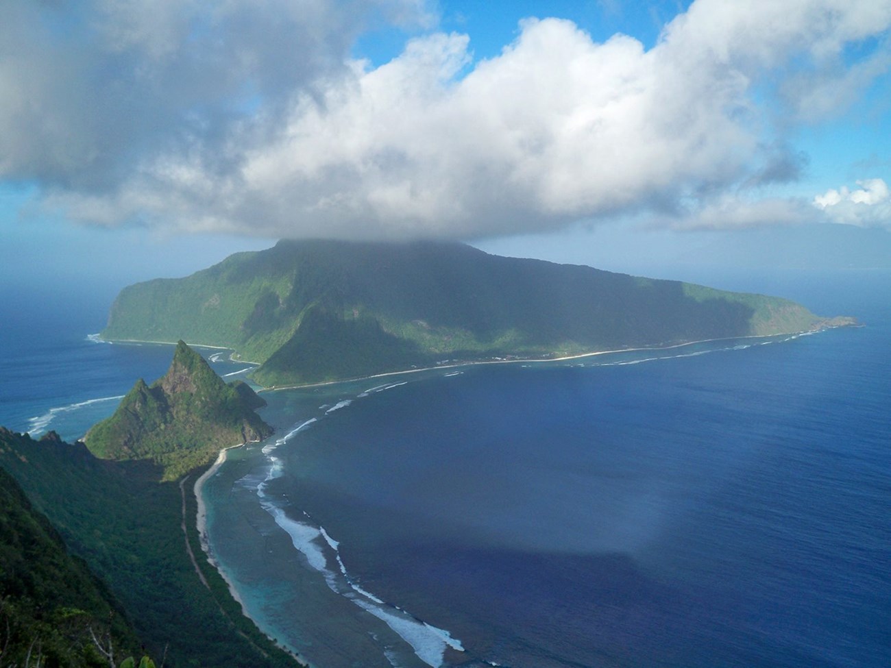
NPS photo. (2015)
Geology and Stratigraphy of the Pacific Island I&M Network Parks
The Pacific Island Inventory & Monitoring Network (PACN) includes nine national park units in Hawai‘i, the Northern Marianas Islands, Guam, and American Samoa. These park units include American Memorial Park (AMME), Haleakalā National Park (HALE), Hawai‘i Volcanoes National Park (HAVO), Kaloko-Honokōhau National Historical Park (KAHO), Kalaupapa National Historical Park (KALA), the National Park of American Samoa (NPSA), Pu‘ukoholā Heiau National Historic Site (PUHE), Pu‘uhonua o Hōnaunau National Historical Park (PUHO), and War in the Pacific National Historical Park (WAPA). The parks that comprise the Pacific Island Network protect a combined 153,604 hectares (379,564 acres) of wilderness and vary in size from 34 hectares (86 acres) in PUHE to 130,887 hectares (323,431 acres) in HAVO.
It should be noted that the use of diacritics and non-English symbols such as the ‘okina (‘, representing a glottal stop) was uncommon in English literature until relatively recently. Most of the older reports cited in this publication render words without these features. In most cases one can “translate” the orthography used here to older usage in the literature by removing macrons and ‘okina (e.g., “Pu‘ukoholā” versus “Puukohola”).
The geology of the Pacific Island Network is dominated by Cenozoic-age igneous rocks that represent the combined processes of hot spot volcanism, subduction, magma generation, and volcanic eruption and growth. The Hawaiian Islands that include HALE, HAVO, KAHO, KALA, PUHE, and PUHO are part of the Hawaiian–Emperor seamount chain, an extensive subaerial and submarine volcanic mountain chain that extends approximately 6,000 km (3,725 mi). Over the last 70 million years, plate tectonic processes have moved the Pacific Plate over the nearly stationary Hawaiian hot spot to create a trail of more than 80 volcanoes. As the Pacific Plate continues to migrate northwestward, new volcanic islands form above the hot spot and emerge from below the sea, such as the current island of Hawai‘i. Volcanic extinction follows as a volcano moves away from the hot spot and erosion becomes the dominant force. Large landslides may occur any time in the growth or quiescence of a volcano, and subaerial erosion is on-going whenever the volcano is emergent (Sherrod et al. 2007). The extinct volcano also begins to subside. Similar to the Hawaiian Islands, the islands of American Samoa are part of a volcanic archipelago that overlies the Samoa hot spot. The islands of American Samoa, including the three islands of NPSA (Tutuila, Taʻū, and Ofu), are geologically young and formed within the last two million years (Thornberry-Ehrlich 2008).
The geologic setting of Guam and Saipan in the Northern Marianas Islands is part of a feature commonly called the “Ring of Fire”, an active, dynamic boundary where oceanic crust of the Pacific Plate is subducting beneath neighboring tectonic plates to be recycled deep within the Earth (Thornberry-Ehrlich 2012). The Mariana Trench—east of Guam—is the deepest point on the surface of Earth’s crust, extending more than 11 km (7 mi) below the ocean’s surface. Here, the Pacific Plate subducts northwestward beneath the Mariana and Philippine plates, facilitating the earthquakes and volcanoes associated with the region. As the Pacific Plate subducts deeper into the earth, rocks of the oceanic plate experience elevated temperature and pressure conditions. As these rocks heat up and lose moisture, the overlying rocks of the Mariana and Philippine plates begin to partially melt due to the moisture that has been driven off the down-going plate and generate magma. Molten rock generated by partial melting migrates upward where it erupts at the surface to blanket older rocks with lava and pyroclastic flows, while large masses of magma remain underground and cool to form coarsely crystalline basement rocks. The islands of Guam (AMME) and Saipan (WAPA) are a classic example of a volcanic island arc, a curved line of volcanoes rising above the ocean floor that are fueled by magma generation associated with subduction (Thornberry-Ehrlich 2012). Much of the surface of both Guam and Saipan is limestone that formed in shallow seas and was uplifted due to up-warping of the overlying plate (Schlanger et al. 1964; Behrens 1976).
The geologic setting of Guam and Saipan in the Northern Marianas Islands is part of a feature commonly called the “Ring of Fire”, an active, dynamic boundary where oceanic crust of the Pacific Plate is subducting beneath neighboring tectonic plates to be recycled deep within the Earth (Thornberry-Ehrlich 2012). The Mariana Trench—east of Guam—is the deepest point on the surface of Earth’s crust, extending more than 11 km (7 mi) below the ocean’s surface. Here, the Pacific Plate subducts northwestward beneath the Mariana and Philippine plates, facilitating the earthquakes and volcanoes associated with the region. As the Pacific Plate subducts deeper into the earth, rocks of the oceanic plate experience elevated temperature and pressure conditions. As these rocks heat up and lose moisture, the overlying rocks of the Mariana and Philippine plates begin to partially melt due to the moisture that has been driven off the down-going plate and generate magma. Molten rock generated by partial melting migrates upward where it erupts at the surface to blanket older rocks with lava and pyroclastic flows, while large masses of magma remain underground and cool to form coarsely crystalline basement rocks. The islands of Guam (AMME) and Saipan (WAPA) are a classic example of a volcanic island arc, a curved line of volcanoes rising above the ocean floor that are fueled by magma generation associated with subduction (Thornberry-Ehrlich 2012). Much of the surface of both Guam and Saipan is limestone that formed in shallow seas and was uplifted due to up-warping of the overlying plate (Schlanger et al. 1964; Behrens 1976).
A Brief Geologic History
A few examples of events and Network resources in each geologic time period are highlighted below, from youngest to oldest.
The geology of the park units of the PACN are entirely composed of Cenozoic-age rocks, primarily volcanic igneous rocks associated with the formation of the islands of Hawai‘i, Guam, and Saipan. Some of the oldest bedrock units occur in WAPA and consist of the Miocene Umatac Formation, Miocene–Pliocene Alifan Limestone, and Eocene–Oligocene Alutom Formation. The oldest rocks underlying NPSA date to the Pliocene and represent the Asaga Formation on Ofu Island. Rocks of Pliocene–Pleistocene age are found in several park units and include the Mariana Limestone (WAPA), East Moloka‘i Volcanics (KALA), and Pago Volcanics (NPSA).
Numerous Pleistocene and Holocene-age units occur in each of the park units of the PACN. On the island of Hawai‘i, numerous lava flows and pyroclastic deposits are mapped in association with the volcanoes Mauna Loa in HAVO (Ka‘ū Basalt, Pāhala Ash) and PUHO (Ka‘ū Basalt), Kīlauea in HAVO (Puna Basalt, Pāhala Ash, Hilina Basalt), Hualālai in KAHO (Hualālai Volcanics), Mauna Kea in PUHE (Hāmākua Volcanics), and Kohala in PUHE (Hāwī Volcanics, Pololū Volcanics). On the island of Maui, the geology of HALE consists of the Pleistocene Kula Volcanics and Pleistocene–Holocene Hāna Volcanics. The Pleistocene Kalaupapa Volcanics are mapped in KALA and compose the entire northern peninsula of the island of Moloka‘i. On the islands of NPSA, the Pleistocene Lata Formation, Luatele Formation, and Holocene Fitiʻuta Formation occur on Taʻū Island; Pleistocene–Holocene non-calcareous sediments are mapped on Ofu Island; and Holocene-age calcareous sand deposits are found on Tutuila Island. The geology of AMME on the island of Guam consists entirely of Holocene marsh deposits, emerged carbonate sands, and artificial fill. Holocene-age surficial beach deposits and alluvium are found in WAPA.
Mesozoic rocks are not exposed in any of the parks in PACN.
Paleozoic rocks are not exposed in any of the parks in PACN.
Precambrian rocks are not exposed in any of the parks in PACN.
Geology & Soils—Pacific Islands Network Parks
Type Sections—Pacific Islands Network

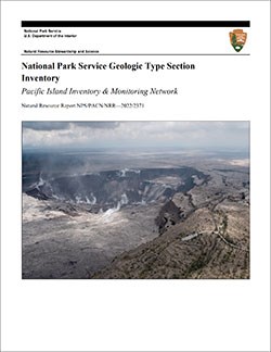
The geologic history above is excerpted from a report titled, "National Park Service geologic type section inventory: Pacific Island Inventory & Monitoring Network". Type sections are essential reference locations for the geoscientists who study geologic history and paleontology. A summary of the type sections in each park can be found at the links below.
-
American Memorial Park, Guam (no designated stratotypes identified)
-
Haleakalā National Park, Hawai‘i (contains three identified stratotypes)
-
Hawai‘i Volcanoes National Park, Hawai‘i (contains 28 identified stratotypes)
-
Kaloko-Honokōhau National Historical Park, Hawai‘i (no designated stratotypes identified)
-
Kalaupapa National Historical Park, Hawai‘i (contains three identified stratotypes)
-
National Park of American Samoa, American Samoa (contains one identified stratotype)
-
Pu‘ukoholā Heiau National Historic Site, Hawai‘i (no designated stratotypes identified)
-
Pu‘uhonua o Hōnaunau National Historical Park, Hawai‘i (no designated stratotypes identified)
-
War in the Pacific National Historical Park, Guam (contains one identified stratotype)
The full Network report is available in digital format from:
Please cite this publication as:
-
Henderson TC, Santucci VL, Connors T, Tweet JS. 2022. National Park Service geologic type section inventory: Pacific Island Inventory & Monitoring Network. Natural Resource Report. NPS/PACN/NRR—2022/2371. National Park Service. Fort Collins, Colorado.
NPS Stratotype Inventory
Fossil Resources—Pacific Islands Network

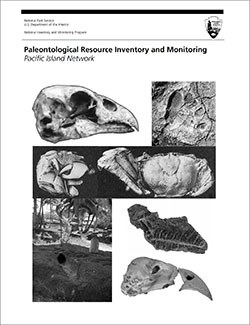
Between 2002 and 2011, network-based paleontological resource inventories were completed for all the 32 I&M networks, and six of the earliest were completely updated between 2012 and 2016. The report linked below summarizes the paleontological resources of all park units in the Pacific Island Inventory & Monitoring Network (PACN). The report provides geologic background and paleontological resource data for each park to support management operations, planning, and science-based decision making as required by NPS management policies and the Paleontological Resources Preservation Act (2009).
The full report is available in digital format from
Please cite this publication as:
-
Hunt, R. K., V. L. Santucci, and J. P. Kenworthy. 2007. Paleontological Resource Inventory and Monitoring, Pacific Island Network. National Park Service TIC# D-24. 57 pages.
Geodiversity Atlas pages—by Inventory & Monitoring Network
Arctic Network Index
Central Alaska Network Index
Chihuahuan Desert Network Index
Cumberland Piedmont Network Index
Eastern Rivers and Mountains Network Index
Great Lakes Network Index
Greater Yellowstone Network Index
Gulf Coast Network Index
Heartland Network Index
Klamath Network Index
Mediterranean Coast Network Index
Mid-Atlantic Network Index
Mojave Desert Network Index
National Capital Network Index
North Coast and Cascades Network Index
Northeast Coastal and Barrier Network Index
Northeast Temperate Network Index
Northern Colorado Plateau Network Index
Northern Great Plains Network Index
Pacific Islands Network Index
Rocky Mountain Network Index
San Francisco Bay Area Network Index
Sierra Nevada Network Index
Sonoran Desert Network Index
South Florida/Caribbean Network Index
Southeast Alaska Network Index
Southeast Coast Network Index
Southern Colorado Plateau Network Index
Southern Plains Network Index
Southwest Alaska Network Index
Upper Columbia Basin Network Index
Geodiversity Atlas pages—by State, U.S. Commonwealth, and Territories
Alabama | Alaska | Arizona | Arkansas | California | Colorado | Connecticut | District of Columbia | Delaware | Florida | Georgia | Hawaii | Idaho | Illinois | Indiana | Iowa | Kansas | Kentucky | Louisiana | Maine | Maryland | Massachusetts | Michigan | Minnesota | Mississippi | Missouri | Montana | Nebraska | Nevada | New Hampshire | New Jersey | New Mexico | New York | North Carolina | North Dakota | Ohio | Oklahoma | Oregon | Pennsylvania | Rhode Island | South Carolina | South Dakota | Tennessee | Texas | Utah | Vermont | Virginia | Washington | West Virginia | Wisconsin | Wyoming
U.S. Commonwealth and Territories
Region 2: South Atlantic-Gulf (Includes Puerto Rico and the U.S. Virgin Islands)
Region 3: Great Lakes
Region 4: Mississippi Basin
Region 5: Missouri Basin
Region 6: Arkansas-Rio Grande-Texas-Gulf
Region 7: Upper Colorado Basin
Region 8: Lower Colorado Basin
Region 9: Columbia-Pacific Northwest
Region 10: California-Great Basin
Region 11: Alaska
Region 12: Pacific Islands (American Samoa, Hawaii. Guam, Commonwealth of the Northern Mariana Islands)
Last updated: February 21, 2025
