NPS photo by C. Aurrecoechea.
Geology and Stratigraphy of the Mediterranean Coast I&M Network
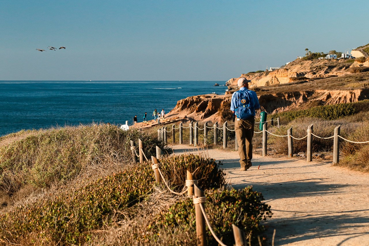
The Mediterranean Coast Inventory & Monitoring Network (MEDN) includes three NPS areas in coastal southern California. These parks are within one of the world’s few areas of Mediterranean biome, characterized by a combination of distinct geography (mid-latitudinal west coast), climate (mild rainy winters and warm dry summers, with cool offshore ocean currents), and vegetation (evergreen or drought-adapted deciduous shrublands). The Mediterranean biome of southern California is an area where a highly diverse flora and fauna with significant endemism has been strongly impacted by human utilization.The following summary of MEDN geology is paraphrased after Tweet et al. (2012). The Mediterranean Coast area of southern California has complex geology stemming from the interactions of the western margin of the North American Plate with adjacent oceanic plates. The MEDN is composed of terranes (distinct blocks of continental crust) that had accreted to western North America by the late Mesozoic (see Geologic Time Scale). Cabrillo National Monument is located within the Peninsular Ranges terrane, and Channel Islands National Park and Santa Monica Mountains National Recreation Area are within the Transverse Ranges terrane. These two terranes were adjacent to each other when they were accreted. During the mid-Cenozoic, subduction of oceanic crust beneath the North American Plate set off a series of events including the creation of the San Andreas fault system, rifting of Baja California from the rest of Mexico, and the transform displacement of the Transverse Ranges block from near San Diego, which resulted in it moving north and rotating approximately 90° clockwise.
A Brief Geologic History
A few examples of events and Network resources in each geologic time period are highlighted below, from youngest to oldest.
There is no record of deposition at CABR after the Cretaceous until the Pleistocene, but CHIS and SAMO have excellent Cenozoic records documenting a variety of settings over most of the era. The CHIS record is split among five islands. Two of the islands, Anacapa Island and Santa Barbara Island, are limited to mid-Miocene volcanics and associated sedimentary rocks, and a veneer of Quaternary sedimentation. The other three have complex geologic histories that are only partly understood, and the names of many of the formations may be revised after further study. The basic pattern for these islands is marine deposition during the late Paleocene and Eocene, then continental shelf to terrestrial deposition or no deposition in the Oligocene, followed by marine conditions in the early Miocene interrupted by extensive volcanism brought on by the movement of the Transverse Ranges block, and preserved deposition ending in the middle Miocene.
San Miguel Island’s Cenozoic bedrock includes undifferentiated rocks of the Pozo–Cañada Formation (middle Paleocene–middle Eocene), the South Point Formation (middle–upper Eocene), an interval that includes either or both of the Vaqueros and Rincon Formations (upper Oligocene?– lower Miocene), the San Miguel Volcanics (lower Miocene), the Beechers Bay Formation (lower– middle Miocene), and the Monterey Formation (middle Miocene). Santa Rosa Island has a broadly similar stratigraphic sequence: the South Point Formation (middle Eocene), Cozy Dell Shale (middle–upper Eocene), Sespe Formation (Oligocene), Vaqueros Formation (lower Miocene), 5 Rincon Formation (lower Miocene), Santa Rosa Island Volcanics (lower Miocene), Monterey Formation (lower–middle Miocene), San Onofre Breccia (lower–middle Miocene), and Beechers Bay Formation (lower–middle Miocene). Santa Cruz Island is composed of two juxtaposed crustal fragments, with most of the stratigraphic diversity south and west of the island-spanning Santa Cruz Island Fault. South of the fault, the stratigraphic section includes the Pozo Formation (upper Paleocene–lower Eocene), Cañada Formation (lower–middle Eocene), Jolla Vieja Formation (middle–upper Eocene), Cozy Dell Shale (middle–upper Eocene), Vaqueros Formation (Oligocene– lower Miocene), Rincon Formation (lower Miocene), San Onofre Breccia (lower–middle Miocene), Beechers Bay Formation (lower–middle Miocene), and Blanca Formation (middle Miocene). The bedrock north of the fault is limited to the Santa Cruz Island Volcanics and Monterey Formation, both of lower–middle Miocene age. All three islands are covered with Quaternary deposits. The deposits on Santa Cruz and Santa Rosa Islands are sometimes known as the Santa Cruz Island Formation and Santa Rosa Island Formation, respectively. Santa Cruz Island also has two areally limited older Pleistocene units, the Potato Harbor Formation and Middle Anchorage Alluvium. Quaternary deposition on CHIS includes marine terrace deposits and terrestrial alluvium.
SAMO is an areally extensive park with somewhat distinct Cenozoic stratigraphic sequences in different areas of the park. In some cases, this difference is partly a result of distance. The most complete Cenozoic section at SAMO is preserved in the Santa Monica Mountains proper, where a sequence ranging from Paleocene to Pleistocene in age is present. The rock record here is exceedingly complex because of facies changes. The Cenozoic record begins with three Paleocene– Eocene units, the Simi Conglomerate (a locally present Paleocene unit), Coal Canyon Formation / Santa Susana Formation (middle–late Paleocene), and the Llajas Formation (early–middle Eocene, also only present locally). Next is the middle Eocene–early Miocene terrestrial Sespe Formation found in the central and western area of the mountains, intertonguing in part with the late Oligocene– early Miocene marine Vaqueros Formation. Above them are the three formations of the early–middle Miocene Topanga Group (Topanga Formation of earlier workers), in ascending order the dominantly marine Topanga Canyon Formation, the dominantly volcanic Conejo Volcanics, and the marine Calabasas Formation. A marine unit known variously as the Modelo or Monterey Formation (middle–late Miocene) unconformably overlies all older units. The area south of the Malibu Coast fault has a different Miocene sequence that includes the early–middle Miocene Trancas Formation and Zuma Volcanics, which are overlain by the Monterey Formation (middle–late Miocene). In the Simi Hills section in northern SAMO there is a slightly different Cenozoic sequence. It begins with the Simi Conglomerate and the overlying Las Virgenes Sandstone (Paleocene), which are succeeded by the Santa Susana Formation (late Paleocene–early Eocene) and Llajas Formation (early–middle Eocene). A section of younger rocks broadly similar to those of the Santa Monica Mountains proper are present north of the Simi Hills. As with CHIS, there is a general paucity of post-Miocene strata at SAMO until the surficial cover of the late Quaternary age, although there are small isolated exposures of Pliocene and Pleistocene rocks in the Santa Monica Mountains proper.
Mesozoic rocks can be observed at all three MEDN parks. The oldest rocks date to the latter part of the Jurassic and include the Santa Monica Slate of SAMO and the Santa Cruz Island Schist and Willows Diorite of CHIS. These are interpreted as representing parts of oceanic volcanic arcs and associated areas. Convergent tectonic activity through the Early Cretaceous produced intrusive igneous rocks at CHIS (Alamos Plutonite) and SAMO (unnamed granitic rocks). The metamorphic Catalina Schist has also been reported at SAMO. Unmetamorphosed sedimentary rocks first appear in the Late Cretaceous. The Cabrillo and Point Loma Formations make up the bedrock of CABR. Rocks of Late Cretaceous age are known at San Miguel Island of CHIS, but the designation has long been controversial. Three Late Cretaceous units have been identified in SAMO, the Chatsworth, Trabuco, and Tuna Canyon Formations. The CABR and CHIS rocks were deposited in submarine fan systems between a subduction zone to the west and an Andean-type mountain range to the east, whereas the SAMO rocks represent a range of environments from terrestrial to deep-water submarine fans. Cretaceous rocks in the Santa Monica Mountains area remain poorly understood.
The MEDN parks do not include any exposed or mapped Paleozoic rocks within park boundaries.
The MEDN parks do not include any exposed or mapped Precambrian rocks within park boundaries.
Geology & Soils—Mediterranean Coast Network Parks
Type Sections—Mediterranean Coast Network

The geologic history above is excerpted from a report titled, "National Park Service geologic type section inventory: Mediterranean Coast Inventory & Monitoring Network". Type sections are essential reference locations for the geoscientists who study geologic history and paleontology. A summary of the type sections in each park can be found at the links below.
-
Cabrillo National Monument, California (contains two identified stratotypes)
-
Channel Islands National Park, California (contains eleven identified stratotypes)
-
Santa Monica Mountains National Recreation Area, California (contains 25 identified stratotypes)
The full Network report is available in digital format from:
Please cite this publication as:
-
Henderson T, Tweet JS, Santucci VL, Connors T. 2021. National Park Service geologic type section inventory: Mediterranean Coast Inventory & Monitoring Network. Natural Resource Report. NPS/MEDN/NRR—2021/2279. National Park Service. Fort Collins, Colorado.
NPS Stratotype Inventory
Fossil Resources—Mediterranean Coast Network

Between 2002 and 2011, network-based paleontological resource inventories were completed for all the 32 I&M networks, and six of the earliest were completely updated between 2012 and 2016. The report linked below summarizes the paleontological resources of all park units in the Mediterranean Coast Inventory & Monitoring Network (MEDN). The report provides geologic background and paleontological resource data for each park to support management operations, planning, and science-based decision making as required by NPS management policies and the Paleontological Resources Preservation Act (2009).
The full report is available in digital format from
-
DataStore - Paleontological resource inventory and monitoring: Mediterranean Coast Network (nps.gov)
Please cite this publication as:
-
Tweet, J. S., V. L. Santucci, and T. Connors. 2012. Paleontological resource inventory and monitoring: Mediterranean Coast Network. Natural Resource Technical Report NPS/MEDN/NRTR—2012/640. National Park Service, Fort Collins, Colorado.
Geodiversity Atlas pages—by Inventory & Monitoring Network
Arctic Network Index
Central Alaska Network Index
Chihuahuan Desert Network Index
Cumberland Piedmont Network Index
Eastern Rivers and Mountains Network Index
Great Lakes Network Index
Greater Yellowstone Network Index
Gulf Coast Network Index
Heartland Network Index
Klamath Network Index
Mediterranean Coast Network Index
Mid-Atlantic Network Index
Mojave Desert Network Index
National Capital Network Index
North Coast and Cascades Network Index
Northeast Coastal and Barrier Network Index
Northeast Temperate Network Index
Northern Colorado Plateau Network Index
Northern Great Plains Network Index
Pacific Islands Network Index
Rocky Mountain Network Index
San Francisco Bay Area Network Index
Sierra Nevada Network Index
Sonoran Desert Network Index
South Florida/Caribbean Network Index
Southeast Alaska Network Index
Southeast Coast Network Index
Southern Colorado Plateau Network Index
Southern Plains Network Index
Southwest Alaska Network Index
Upper Columbia Basin Network Index
Geodiversity Atlas pages—by State, U.S. Commonwealth, and Territories
Alabama | Alaska | Arizona | Arkansas | California | Colorado | Connecticut | District of Columbia | Delaware | Florida | Georgia | Hawaii | Idaho | Illinois | Indiana | Iowa | Kansas | Kentucky | Louisiana | Maine | Maryland | Massachusetts | Michigan | Minnesota | Mississippi | Missouri | Montana | Nebraska | Nevada | New Hampshire | New Jersey | New Mexico | New York | North Carolina | North Dakota | Ohio | Oklahoma | Oregon | Pennsylvania | Rhode Island | South Carolina | South Dakota | Tennessee | Texas | Utah | Vermont | Virginia | Washington | West Virginia | Wisconsin | Wyoming
U.S. Commonwealth and Territories
Region 2: South Atlantic-Gulf (Includes Puerto Rico and the U.S. Virgin Islands)
Region 3: Great Lakes
Region 4: Mississippi Basin
Region 5: Missouri Basin
Region 6: Arkansas-Rio Grande-Texas-Gulf
Region 7: Upper Colorado Basin
Region 8: Lower Colorado Basin
Region 9: Columbia-Pacific Northwest
Region 10: California-Great Basin
Region 11: Alaska
Region 12: Pacific Islands (American Samoa, Hawaii. Guam, Commonwealth of the Northern Mariana Islands)
Last updated: February 21, 2025
