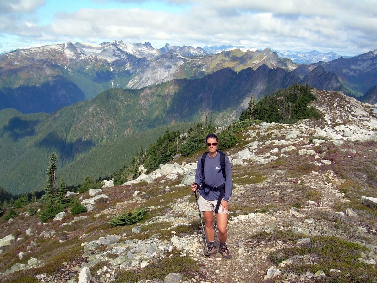
NPS image by Mike Myers.
Introduction

NPS image.
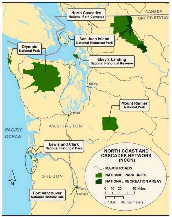
The North Coast and Cascades Inventory and Monitoring Network (NCCN) is composed of nine park units in Oregon and Washington. These are Ebey’s Landing National Historical Reserve (EBLA), Fort Vancouver National Historic Site (FOVA), Lake Chelan National Recreation Area (LACH), Lewis and Clark National Historical Park (LEWI), Mount Rainier National Park (MORA), North Cascades National Park (NOCA), Olympic National Park (OLYM), Ross Lake National Recreation Area (ROLA), and San Juan Island National Historical Park (SAJH); LACH, NOCA, and ROLA are managed together as North Cascades National Park Complex or National Park Service Complex (also NOCA). The parks that comprise the North Coast and Cascades Network protect a combined 749,086 hectares (1,851,032 acres) and vary in size from 83 ha (207 acres) (FOVA) to 373,383 ha (922,650 acres) (OLYM). Elevations within the network range from sea level (EBLA, LEWI, OLYM, and SAJH) to 4,392 m (14,410 ft) above sea level (MORA).
Geology and Stratigraphy
Rocks of the North Coast and Cascade Network consist of a geologic mosaic made of volcanic island arcs, deep ocean sediments, basaltic ocean floor, fragments of old continents, submarine fans, glacial debris, and pieces of deep sub-crustal mantle (Tabor and Haugerud 1999). In a broad sense, the geologic setting of the NCCN is well understood and records at least 400 million years of dynamic earth processes. Due to plate tectonics, dense oceanic crustal plates that comprise the Pacific Ocean Basin (e.g., the Juan de Fuca Plate, a remnant of the Farallon Plate) are converging with comparatively less-dense continental crust composing the North American Plate. Dense oceanic crust is effectively being driven beneath the more buoyant continental crustal rocks that comprise North America to be recycled deep within the Earth. This process, called subduction, has been heavily influencing the NCCN landscape since the Mesozoic Era.
Off the Pacific Northwest coast, subducting oceanic crust acted like a conveyor belt, transporting marine sediments and small landmasses (fragments of volcanic island arcs) closer to the continental margin as it descended beneath North America. At the subduction zone, where the oceanic crust plunged beneath the continental margin, marine sediments were scraped off the down-going slab, resulting in a jumbled and chaotic suite of marine rocks (referred to as “mélange”—a French word meaning “mixture”) that formed an accretionary prism (Fay et al. 2009). The Olympic Mountains (OLYM) represent such an accretionary prism that has been further uplifted, folded, and eroded into the rugged peaks seen today. Other diverse rock suites, called “terranes”, were also transported by the conveyor belt until they were compressed, uplifted, and welded to the continent in a process called accretion. Many terranes of the NCCN parks are geologically and temporally distinct from one another and were subsequently juxtaposed to form a mosaic of diverse rock assemblages. The San Juan Island Archipelago (SAJH), portions of the Olympic Peninsula (OLYM), and a large part of the North Cascade Range (NOCA) are underlain by terranes. Specific examples of accretionary terranes within NCCN include the Chelan Mountains Terrane and Little Jack Mountain Terrane of NOCA, the Turtleback Complex, Deadman Bay Terrane, and Decatur Terrane of SAJH, and the Crescent Terrane, Sooes Terrane, and Ozette Terrane of OLYM.
Deeper inside the earth, subducting rocks of the oceanic plate experience elevated temperature and pressure conditions. As these rocks heat up and lose moisture, the overlying rocks of the North American Plate begin to partially melt and generate magma. Molten rock generated by partial melting erupted at the surface to blanket older rocks with lava and pyroclastic flows while large masses of magma intruded from below and cooled to form hard crystalline basement rocks. The tall, steep-sided volcanoes of the Cascade Range, including Mount Rainier (MORA) are a part of an extensive active volcanic arc created by the subduction of oceanic crust beneath the western margin of Washington, Oregon, Northern California, and southern British Columbia.
In the more recent geologic past, Pleistocene-age continental ice sheets and alpine glaciers have eroded the regional landscape as it has continuously uplifted. The Cordilleran Ice Sheet deposited thick blankets of glacial till deposits during its initial advance and left behind glacial outwash deposits during its final retreat. Such deposits dominate the geologic landscape of SAJH and EBLA. Continental glaciation has contributed to the geology of OLYM and NOCA, but alpine glaciation is more dominant in those areas (Fay et al. 2009).
Intimate details of the geologic history of the NCCN remain somewhat elusive and problematic. Precise geologic reconstructions showing the evolution of the Pacific Northwest region are controversial in part due to the complex, regional geologic processes operating in this area, but also due to dense vegetation and rugged topography that limit access to exposures (Fay et al. 2009). Although the larger geologic framework is largely understood, some pieces of information are still not well understood. Some of the outstanding questions that still need addressed include the timing of certain glacial events, as well as the timing of certain structural and metamorphic events.
(Geology and Stratigraphy, Henderson 2022)
A Brief Geologic History
A few examples of events and Network resources in each geologic time period are highlighted below, from youngest to oldest.
The Cenozoic geology of the North Coast and Cascades Inventory & Monitoring Network is a testament to volcanism associated with the subduction of oceanic crust beneath the western margin of North America (Cascade volcanism) combined with the more recent glacial history of the region.
Cenozoic formations form the entirety of bedrock at Fort Vancouver National Historic Site and include rocks of the Miocene Columbia River Basalt Group (Frenchman Springs Member of the Wanapum Formation), as well as Quaternary-age alluvium of the Columbia River Floodplain and deposits associated with the great Missoula floods (Waitt 1985, 1987).
Dominant lithologies of southwestern Washington and northwestern Oregon in Lewis and Clark National Historical Park include the volcanic rocks of the Eocene Crescent Formation and sedimentary rocks composed primarily of the Oligocene Lincoln Creek Formation. Other geologic units mapped in Lewis and Clark National Historical Park include tuffaceous sedimentary rocks and volcanolithic sandstones of the Eocene Siltstone at Cliff Point and Siltstone at Shoalwater Bay, as well as tuffaceous sediments and sandstones of the Miocene Smuggler Cove formation and Sandstone at Megler. Younger surficial units in Lewis and Clark National Historical Park are Pleistocene–Holocene terrace deposits, eolian dune sand, and Holocene alluvium and beach sand.
In Mount Rainier National Park, the prominent Mount Rainier consists of late Pleistocene and Holocene lava flows and interbeds of volcaniclastic rocks. These younger igneous units partially bury older rocks mapped within the park such as the Eocene–Oligocene Ohanapecosh Formation, Oligocene–Miocene Stevens Ridge Formation, and the Fifes Peak Formation. A number of Pleistocene and younger mudflows (lahar flows), landslides, and surficial deposits are found along the flanks of Mount Rainier.
The North Cascade National Park Complex contains younger Cenozoic igneous rocks of the Pliocene Hannegan Volcanics, Oligocene-age volcanic rocks of Mount Rahm, Pioneer Ridge, and Big Boson Buttes, as well as extensive Oligocene–Miocene-age intrusive rocks of the Cascade Pass, Snoqualmie, and Index families (including the Chilliwack composite batholith).
A major portion of bedrock at Olympic National Park consists of rocks associated with the Eocene–Oligocene Olympic Subduction Complex, a suite of rock units which represent the accretionary prism of the Cascadia Subduction Zone. Within the boundaries of Olympic National Park, the complex consists of the Crescent Terrane (including the Twin River Group, Aldwell Formation, Crescent Formation, Lyre Formation, and the Blue Mountain unit of Tabor and Cady 1978), Ozette Terrane, Sooes Terrane, and the Hoh rock assemblage.
Pleistocene-age glacial deposits are found with Ebey’s Landing National Historical Reserve, North Cascades National Park, Olympic National Park, and San Juan Island National Historical Park in the form of glacial till, drift, moraines, and outwash deposits.
Western North Cascades National Park contains rocks of the Late Jurassic–Cretaceous Bell Pass mélange that consist of sandstones, argillites (mudstones and shales), ribbon cherts, mafic rocks, and sheared blocks of other intensely metamorphosed units. Numerous Cretaceous-age metamorphic and igneous units form the crystalline core of North Cascades National Park, Ross Lake National Recreation Area, and Lake Chelan National Recreation Area, including the Early Cretaceous Eastern Metamorphic Suite (including the Darrington Phyllite and Shuksan Greenschist), Late Cretaceous–middle Eocene Chelan Mountains Terrane (including the Cascade River Schist, Napeequa Schist, and Magic Mountain Gneiss), Skymo Complex of Wallace (1976), Little Jack Mountain Terrane, Skagit Gneiss Complex, Eldorado Orthogneiss, and the Three Fools Sequence of Haugerud et al. (2002).
The only Mesozoic units mapped within Olympic National Park are located along the coast and include Jurassic– Paleocene-age gabbro and diorite rocks associated with Portage Head/Point of the Arches block.
In San Juan Island National Historical Park there are numerous Mesozoic-age units that include the Triassic–Jurassic Deadman Bay Terrane and Orcas Chert. Crystalline rocks, volcanics, and metamorphosed marine sediments of the Jurassic–Cretaceous Decatur Terrane, Lopez Structural Complex, Lummi Formation, and Constitution Formation are also mapped within the historical park. The Lopez Structural Complex includes slices of Turtleback Terrane, Garrison Schist, and marine sedimentary rocks derived from the Lummi Formation of the Decatur Terrane.
Some of the oldest Paleozoic rocks mapped in the North Coast and Cascades Network are found in the North Cascades National Park Complex (North Cascades National Park, Ross Lake National Recreation Area, and Lake Chelan National Recreation Area) and consist of ribbon chert, limestone, greenstones, volcanic breccias, tuffs, and pillow lavas of the Pennsylvanian–Triassic Hozomeen Group. These rocks are found within or near the Ross Lake Fault zone along eastern North Cascades National Park and northern Ross Lake National Recreation Area.
San Juan Island National Historical Park contains isolated exposures of the Permian–Triassic Garrison Schist, a high-pressure metamorphic unit located at Garrison Bay near Bell Point.
Precambrian rocks are not exposed in any of the parks in the North Coast and Cascades Inventory & Monitoring Network.
(Geologic History, Henderson 2022)
Related Links
Geology & Soils—North Coast and Cascades Network Parks
Network Monitoring Activities
The North Coast and Cascades Inventory & Monitoring Network actively monitors several physical and biological indicators in Network parks to track overall the health and condition of resources and ecosystems. Monitoring of physical atributes related geologic processes and resources include:
-
NCCN—Glacier Monitoring (OLYM, MORA, NOCA)
-
NCCN—Landscape Change Monitoring (OLYM, MORA, NOCA, LEWI)
Type Sections—North Coast and Cascades Network

The geologic history above is excerpted from a report titled, "National Park Service Geologic Type Section Inventory: North Coast and Cascades Inventory & Monitoring Network". Type sections are essential reference locations for the geoscientists who study geologic history and paleontology. They are important to America's Geoheritage for their Scientific Value. A summary of the type sections in each park can be found at the link(s) below.
-
Ebey’s Landing National Historical Reserve, Washington (contains one identified stratotype)
-
Fort Vancouver National Historical Site, Oregon and Washington (no designated stratotypes identified)
-
Lewis and Clark National Historical Park, Oregon and Washington (no designated stratotypes identified)
-
Mount Rainier National Park, Washington (contains five identified stratotypes)
-
North Cascades National Park Complex, Washington (contains five identified stratotypes)
-
Olympic National Park, Washington (contains one identified stratotype)
-
San Juan Island National Historical Park, Washington (no designated stratotypes identified)
The full Network report is available in digital format from:
Please cite this publication as:
-
Henderson T and Others. 2022. National Park Service geologic type section inventory: North Coast and Cascades Inventory & Monitoring Network. Natural Resource Report. NPS/NCCN/NRR—2022/2366. National Park Service. Fort Collins, Colorado.
NPS Stratotype Inventory
Fossil Resources—North Coast and Cascades Network

Between 2002 and 2011, network-based paleontological resource inventories were completed for all the 32 I&M networks, and six of the earliest were completely updated between 2012 and 2016. The report linked below summarizes the paleontological resources of all park units in the North Coast and Cascades Inventory & Monitoring Network (NCCN). The report provides geologic background and paleontological resource data for each park to support management operations, planning, and science-based decision making as required by NPS management policies and the Paleontological Resources Preservation Act (2009).
The full report is available in digital format from
-
DataStore - Paleontological resource inventory and monitoring— North Coast and Cascades Network (nps.gov)
Please cite this publication as:
-
Fay, L. C., J. P. Kenworthy, and V. L. Santucci. 2009. Paleontological resource inventory and monitoring— North Coast and Cascades Network. Natural Resource Technical Report NPS/NRPC/NRTR—2009/250. National Park Service, Fort Collins, Colorado.
Geodiversity Atlas pages—by Inventory & Monitoring Network
Arctic Network Index
Central Alaska Network Index
Chihuahuan Desert Network Index
Cumberland Piedmont Network Index
Eastern Rivers and Mountains Network Index
Great Lakes Network Index
Greater Yellowstone Network Index
Gulf Coast Network Index
Heartland Network Index
Klamath Network Index
Mediterranean Coast Network Index
Mid-Atlantic Network Index
Mojave Desert Network Index
National Capital Network Index
North Coast and Cascades Network Index
Northeast Coastal and Barrier Network Index
Northeast Temperate Network Index
Northern Colorado Plateau Network Index
Northern Great Plains Network Index
Pacific Islands Network Index
Rocky Mountain Network Index
San Francisco Bay Area Network Index
Sierra Nevada Network Index
Sonoran Desert Network Index
South Florida/Caribbean Network Index
Southeast Alaska Network Index
Southeast Coast Network Index
Southern Colorado Plateau Network Index
Southern Plains Network Index
Southwest Alaska Network Index
Upper Columbia Basin Network Index
Geodiversity Atlas pages—by State, U.S. Commonwealth, and Territories
Alabama | Alaska | Arizona | Arkansas | California | Colorado | Connecticut | District of Columbia | Delaware | Florida | Georgia | Hawaii | Idaho | Illinois | Indiana | Iowa | Kansas | Kentucky | Louisiana | Maine | Maryland | Massachusetts | Michigan | Minnesota | Mississippi | Missouri | Montana | Nebraska | Nevada | New Hampshire | New Jersey | New Mexico | New York | North Carolina | North Dakota | Ohio | Oklahoma | Oregon | Pennsylvania | Rhode Island | South Carolina | South Dakota | Tennessee | Texas | Utah | Vermont | Virginia | Washington | West Virginia | Wisconsin | Wyoming
U.S. Commonwealth and Territories
Region 2: South Atlantic-Gulf (Includes Puerto Rico and the U.S. Virgin Islands)
Region 3: Great Lakes
Region 4: Mississippi Basin
Region 5: Missouri Basin
Region 6: Arkansas-Rio Grande-Texas-Gulf
Region 7: Upper Colorado Basin
Region 8: Lower Colorado Basin
Region 9: Columbia-Pacific Northwest
Region 10: California-Great Basin
Region 11: Alaska
Region 12: Pacific Islands (American Samoa, Hawaii. Guam, Commonwealth of the Northern Mariana Islands)
Last updated: February 21, 2025
