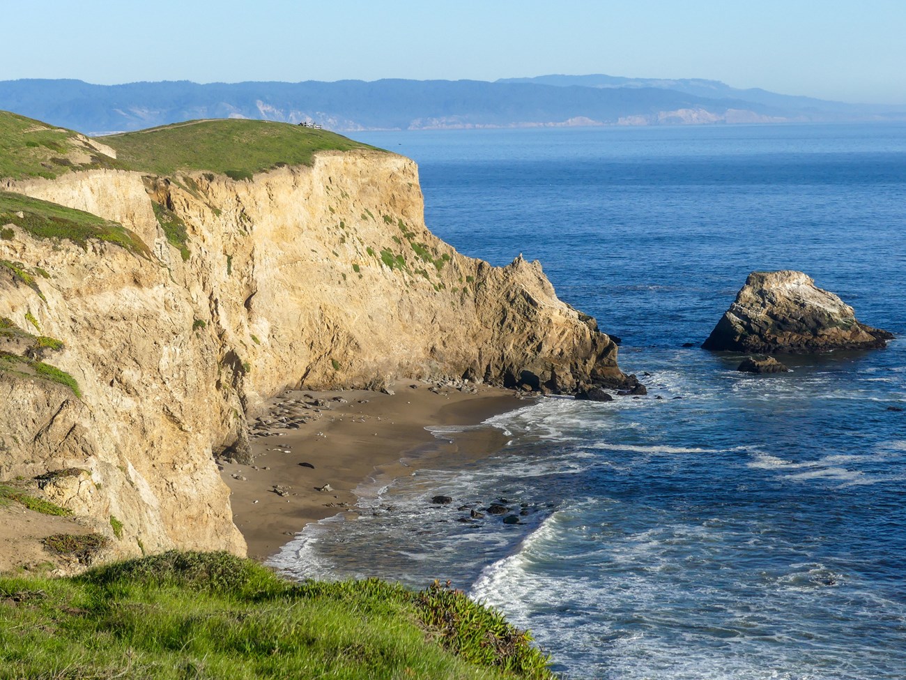
NPS photo by Aiko Goldston
Geology and Stratigraphy of the San Francisco Bay Area I&M Network Parks
The San Francisco Bay Area Inventory & Monitoring Network (SFAN) consists of six national park units along or near the west coast of central California. These parks include Fort Point National Historic Site (FOPO), Golden Gate National Recreation Area (GOGA), John Muir National Historic Site (JOMU), Muir Woods National Monument (MUWO), Pinnacles National Park (PINN), and Point Reyes National Seashore (PORE). Although Eugene O’Neill National Historic Site, Port Chicago Naval Magazine National Memorial, and Rosie the Riveter World War II Home Front National Historical Park are sometimes included in SFAN, they are not “natural resource” parks and are not generally included in geologic inventory reports. The parks that comprise the San Francisco Bay Area Network protect a combined 73,124 hectares (180,694 acres) of wilderness and vary in size from 12 hectares (29 acres) in FOPO to approximately 33,195 hectares (82,027 acres) in GOGA.
The park units of the SFAN are situated in one of the most geologically active areas in the country. The western coast of North America represents an active continental margin that marks the boundary between tectonic plates. Along the California coast, the oceanic Pacific Plate is moving northwest relative to the continental North American Plate along a transform boundary better known as the San Andreas fault system (Stoffer 2005, 2006). The rate of tectonic movement along the San Andreas fault system has varied over time, but modern geodetic data shows about 3.9 cm (1.5 in) of displacement occurs along the fault system in central California annually (Sims 1993; Argus and Gordon 2001). Although these movements are small and comparable to the rate at which fingernails grow, they accumulate to hundreds of kilometers or miles of lateral displacement over millions of years. The rocks underlying many of the SFAN park units originally formed in completely different geologic settings before they were transported north and juxtaposed against strata of very different ages and lithologies (Matthews 1973b; Sims 1993; Stoffer 2002).
The modern-day transform boundary did not always exist in California. Prior to the Oligocene Epoch, about 50 Ma (mega-annum, or millions of years ago; see Appendix B for a geologic time scale), the west coast was characterized by a convergent tectonic boundary where an ancient oceanic plate was thrust beneath the lighter continental North American plate to form an extensive subduction zone. Rocks of the Franciscan Complex, in addition to several Cretaceous-age intrusive bodies mapped in GOGA, PINN, and PORE, formed in association with this ancient collisional tectonic setting. The initiation of the modern transform boundary began in southern California about 28 Ma and extended through the Bay Area approximately 10 Ma, making the San Andreas Fault a relatively young geologic feature (Atwater 1989; Page and Wahrhaftig 1989; Elder 2013).
The geologic setting of the San Francisco Bay area is complex and well-studied. Widely mapped across the park units of the SFAN are basement rocks associated with the Jurassic–Eocene Franciscan Complex. The Franciscan Complex consists of an assemblage of rock types that were deposited in an accretionary wedge and subsequently metamorphosed, sheared, and added to the North American continent (Elder 2013). As tectonism in the San Francisco Bay area evolved from a convergent to a transform regime, geologic processes such as tension, compression, and localized faulting associated with the development of the San Andreas fault system broke the pre-Cenozoic 4 bedrock into blocks which created basins and uplifts (Stoffer 2002; Port 2016). With the exception of the Pinnacles Volcanics in PINN, Cenozoic-age strata that underlie the park units of the SFAN are primarily sedimentary rocks deposited in a range of settings, from marine, to coastal, to nonmarine.
A Brief Geologic History
A few examples of events and Network resources in each geologic time period are highlighted below, from youngest to oldest.
Rocks of the Cenozoic Era are found in all six park units of the SFAN. The Paleocene Martinez Formation underlies southern JOMU and consists of fossiliferous sandstone, shale, and glauconitic sand (Merriam 1897; Arnold 1906; Dickerson 1914). The Eocene Period is represented by the Point Reyes Conglomerate in PORE and the Whiskey Hill Formation in GOGA. The Oligocene–Miocene Pinnacles Volcanics derives its name from exposures throughout PINN that consist of rhyolite, andesite, dacite, and pyroclastic deposits (Matthews 1973b; Sims 1993). The Miocene Monterey Formation is mapped in both PINN and PORE; other Miocene-age units include the Laird Sandstone, Santa Cruz Mudstone, and Santa Margarita Formation in PORE. Mudstone and sandstone of the Miocene–Pliocene Purisima Formation underlie GOGA and PORE. Pliocene-age strata include fossiliferous marine sandstones, shales, and conglomerates of the Pancho Rico Formation in PINN. The Pliocene–Pleistocene Merced Formation is mapped in both GOGA and PORE; other units of similar age include the Santa Clara Formation in GOGA and the Paso Robles Formation in PINN. The youngest formally named units in the SFAN are represented by the Pleistocene Colma Formation, Olema Creek Formation, and Millerton Formation in GOGA. Young surficial deposits mapped throughout the park units of the SFAN include Quaternary alluvium (GOGA, JOMU, MUWO, PINN, PORE), landslide deposits (FOPO, GOGA, PINN, PORE), slope and ravine deposits (FOPO, GOGA), beach and dune sand (GOGA, PORE), marine terrace deposits (GOGA, PORE), and unconsolidated surficial deposits (FOPO).
Mesozoic rocks are mapped in all six of the park units of the SFAN, with some of the oldest rocks consisting of Paleozoic–Mesozoic metamorphic rocks that occur as patches and small roof pendants on Inverness Ridge in PORE. Jurassic-age siliceous volcanic rocks and gabbro underlie portions of southern GOGA. Jurassic–Cretaceous-age rocks of the Franciscan Complex are located in FOPO, GOGA, MUWO, and PORE and represent a wide range of lithologies including sandstone, shale, limestone, greenstone, serpentinite, chert, meta-chert, and mélange. The Cretaceous Period is represented by interbedded sandstone, siltstone, and shale of the Great Valley Sequence in JOMU, in addition to intrusive rocks in GOGA, PINN, and PORE.
Paleozoic rocks are not exposed in any of the parks of the SFAN, with the exception of Paleozoic– Mesozoic-age metamorphic rocks that compose portions of Inverness Ridge in PORE.
Precambrian rocks are not exposed in any of the parks of the SFAN.
Geology & Soils—San Francisco Bay Area Network Parks
Type Sections—San Francisco Bay Area Network

The geologic history above is excerpted from a report titled, "National Park Service geologic type section inventory: San Francisco Bay Area Inventory & Monitoring Network". Type sections are essential reference locations for the geoscientists who study geologic history and paleontology. A summary of the type sections in each park can be found at the links below.
-
Fort Point National Historic Site, California (no designated stratotypes identified)
-
Golden Gate National Recreation Area, California (contains five identified stratotypes)
-
John Muir National Historic Site, California (contains one identified stratotype)
-
Muir Woods National Monument, California (no designated stratotypes identified)
-
Pinnacles National Park, California (contains one identified stratotype)
-
Point Reyes National Seashore, California (contains five identified stratotypes)
The full Network report is available in digital format from:
Please cite this publication as:
-
Henderson TC, Santucci VL, Connors T, Tweet JS. 2022. National Park Service geologic type section inventory: San Francisco Bay Area Inventory & Monitoring Network. Natural Resource Report. NPS/SFAN/NRR—2022/2388. National Park Service. Fort Collins, Colorado.
NPS Stratotype Inventory
Fossil Resources—San Francisco Bay Network

Between 2002 and 2011, network-based paleontological resource inventories were completed for all the 32 I&M networks, and six of the earliest were completely updated between 2012 and 2016. The report linked below summarizes the paleontological resources of all park units in the San Francisco Bay Inventory & Monitoring Network (SFAN). The report provides geologic background and paleontological resource data for each park to support management operations, planning, and science-based decision making as required by NPS management policies and the Paleontological Resources Preservation Act (2009).
The full report is available in digital format from
-
DataStore - Paleontological Resource Inventory and Monitoring—San Francisco Bay Area Network (nps.gov)
Please cite this publication as:
-
Elder, W. P., T. Nyborg, J. P. Kenworthy, and V. L. Santucci. 2007. Paleontological Resource Inventory and Monitoring—San Francisco Bay Area Network. Natural Resource Technical Report NPS/NRPC/NRTR—2008/078. National Park Service, Fort Collins, Colorado.
Geodiversity Atlas pages—by Inventory & Monitoring Network
Arctic Network Index
Central Alaska Network Index
Chihuahuan Desert Network Index
Cumberland Piedmont Network Index
Eastern Rivers and Mountains Network Index
Great Lakes Network Index
Greater Yellowstone Network Index
Gulf Coast Network Index
Heartland Network Index
Klamath Network Index
Mediterranean Coast Network Index
Mid-Atlantic Network Index
Mojave Desert Network Index
National Capital Network Index
North Coast and Cascades Network Index
Northeast Coastal and Barrier Network Index
Northeast Temperate Network Index
Northern Colorado Plateau Network Index
Northern Great Plains Network Index
Pacific Islands Network Index
Rocky Mountain Network Index
San Francisco Bay Area Network Index
Sierra Nevada Network Index
Sonoran Desert Network Index
South Florida/Caribbean Network Index
Southeast Alaska Network Index
Southeast Coast Network Index
Southern Colorado Plateau Network Index
Southern Plains Network Index
Southwest Alaska Network Index
Upper Columbia Basin Network Index
Geodiversity Atlas pages—by State, U.S. Commonwealth, and Territories
Alabama | Alaska | Arizona | Arkansas | California | Colorado | Connecticut | District of Columbia | Delaware | Florida | Georgia | Hawaii | Idaho | Illinois | Indiana | Iowa | Kansas | Kentucky | Louisiana | Maine | Maryland | Massachusetts | Michigan | Minnesota | Mississippi | Missouri | Montana | Nebraska | Nevada | New Hampshire | New Jersey | New Mexico | New York | North Carolina | North Dakota | Ohio | Oklahoma | Oregon | Pennsylvania | Rhode Island | South Carolina | South Dakota | Tennessee | Texas | Utah | Vermont | Virginia | Washington | West Virginia | Wisconsin | Wyoming
U.S. Commonwealth and Territories
Region 2: South Atlantic-Gulf (Includes Puerto Rico and the U.S. Virgin Islands)
Region 3: Great Lakes
Region 4: Mississippi Basin
Region 5: Missouri Basin
Region 6: Arkansas-Rio Grande-Texas-Gulf
Region 7: Upper Colorado Basin
Region 8: Lower Colorado Basin
Region 9: Columbia-Pacific Northwest
Region 10: California-Great Basin
Region 11: Alaska
Region 12: Pacific Islands (American Samoa, Hawaii. Guam, Commonwealth of the Northern Mariana Islands)
Last updated: February 21, 2025
