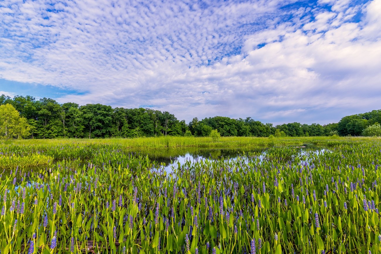
Photo © Jim Roetzel.
Geology and Stratigraphy of the Heartland I&M Network Index
The Heartland Inventory & Monitoring Network (HTLN) consists of 15 national park units distributed across midwestern America in parts of Arkansas, Indiana, Iowa, Kansas, Nebraska, Ohio, Minnesota, and Missouri. These park units include Arkansas Post National Memorial (ARPO), Buffalo National River (BUFF), Cuyahoga Valley National Park (CUVA), Effigy Mounds National Monument (EFMO), George Washington Carver National Monument (GWCA), Herbert Hoover National Historic Site (HEHO), Homestead National Historical Park (HOME), Hopewell Culture National Historical Park (HOCU), Hot Springs National Park (HOSP), Lincoln Boyhood National Memorial (LIBO), Ozark National Scenic Riverways (OZAR), Pea Ridge National Military Park (PERI), Pipestone National Monument (PIPE), Tallgrass Prairie National Preserve (TAPR), and Wilsons Creek National Battlefield (WICR). In addition, although not officially considered part of the HTLN, Fort Scott National Historic Site (FOSC) is included in this report. The parks that comprise the network protect a combined 95,901 hectares (236,978 acres) and feature prehistoric earthworks, battleground sites of the American Revolution and Civil War, free-flowing rivers, geothermal hot springs, and more. Park units of the HTLN range in size from 38,159 hectares (94,293 acres) in BUFF to approximately 7 hectares (17 acres) at FOSC.
The geologic history of the HTLN area goes back to the Precambrian nearly 2 Ga (Giga-annum, billion years ago) and involves several major collisional events that slowly constructed the proto-North American continent (Laurentia) and assembled the configuration of the American Midwest (see Geologic Time Scale). The Proterozoic Penokean Orogeny occurred approximately ~1.88 Ga and resulted in the accretion of crustal material (terranes) to Laurentia that represent portions of modern-day Iowa, Michigan, Minnesota, Missouri, and Wisconsin (Schulz and Cannon 2007). The Central Plains Orogeny that occurred ~1.8 to 1.63 Ga incorporated additional terranes that would become parts of Kansas and Nebraska (Sims and Peterman 1986). Approximately 1.4 Ga to 0.99 Ga marks a period of volcanic activity, rift basin development, and rift basin infilling across the North American continent (Hunt et al. 2008).
The predominant bedrock underlying the park units of HTLN consists of Paleozoic sedimentary rocks featuring a thick sequence of carbonate rocks. Limestones and dolostones that are widespread throughout the network were originally deposited in warm, shallow marine settings and are responsible for the diverse karst landscapes that exist in BUFF and OZAR. The Paleozoic stratigraphy of the Midwest records numerous depositional changes resulting from global sea level fluctuations, domal uplifts, and orogenic events including the collisional episodes that produced the Appalachian–Ouachita Mountains (Thomas et al. 2021). Uplift and erosion of the newly formed mountains provided immense amounts of sedimentary material that was eventually deposited in a variety of marine, coastal, and terrestrial settings.
The rock record of the Cenozoic Era in the midwestern United States tells the story of numerous glacial advances and erosion. The northern portions of the United States, including Indiana, Iowa, Minnesota, and Ohio, were once covered by massive continental glaciers, although minor glaciated periods also occurred in parts of Kansas, Missouri, and Nebraska. During periods of glacial retreat, large amounts of glacial meltwater flowed southward and deposited vast amounts of till that blanketed older underlying strata. Glacially derived sands and gravels that were eroded and transported by the ancestral Mississippi and Ohio Rivers were deposited along the Mississippi Embayment in Missouri and Arkansas to form the western and eastern lowlands in Arkansas (Hunt et al. 2008). Throughout the Holocene, the Midwest has continued to experience erosion, as dynamic fluvial systems continue to incise through strata to produce terrace deposits and alluvium (unconsolidated clay, silt, sand, and gravel).
A Brief Geologic History
A few examples of events and Network resources in each geologic time period are highlighted below, from youngest to oldest.
Some of the Cenozoic rocks and deposits found in many of the park units of the HTLN represent multiple glacial episodes that shaped the Midwest landscape and deposited enormous amounts of glacial outwash and till (ARPO, HEHO, HOME, HOCU, and PIPE). The oldest Cenozoic units are found at TAPR and consist of Neogene colluvium and alluvium deposits. Quaternary tufa deposits associated with geothermal hot spring activity are present in HOSP. Some of the youngest units mapped within the park units of the HTLN include Pleistocene and Holocene terrace deposits, alluvium, and colluvium associated with modern fluvial and stream settings (ARPO, BUFF, FOSC, OZAR, and PIPE).
Rocks of the Mesozoic Era are largely absent in the geologic record of HTLN parks, where more erosion than deposition was taking place during this period. The only bedrock representative of this time is the Cretaceous-age Dakota Sandstone underlying HOME.
Sedimentary rocks of the Paleozoic Era are widely distributed across the Midwest and occur within 14 of the HTLN park units. Cambrian formations include the Jordan Sandstone, St. Lawrence Formation, and Lone Rock Formation in EFMO, and the Eminence and Potosi Dolomites that underlie OZAR. The Ordovician Period is represented by a thick stratigraphic sequence of sedimentary rock that includes the Cason Shale, Kimmswick Limestone, Fernvale Limestone, Everton Formation, Powell Dolomite, Cotter Dolomite, Plattin Limestone, and St. Peter Sandstone at BUFF. Another diverse suite of Ordovician bedrock is mapped at EFMO, consisting of the Shakopee Formation, Oneota Formation, St. Peter Sandstone, and formations associated with the Galena Group (Dunleith Formation, Decorah Formation, Platteville Formation, and Glenwood Formation). Other units of similar age include the Roubidoux Formation, Gasconade Dolomite, and Jefferson City Dolomite that underlie OZAR, as well as the Bigfork Chert in HOSP.
Rocks of the Silurian Period underlie four park units of HTLN but are best represented by the carbonate-dominated bedrock at HOCU that consists of the Tymochtee Dolomite, Greenfield Dolomite, Peebles Dolomite, Lilly Formation, and Bisher Formation. Additional Silurian rocks include undifferentiated limestones in BUFF, the Scotch Grove Formation and Gower Formation at HEHO, and the Missouri Mountain Shale and Polk Creek Shale at HOSP. Several formations of the Devonian Period are found in multiple parks and include the Ohio Shale, Berea Sandstone, and Bedford Shale in both CUVA and HOCU. Additional units of similar age include the Olentangy Shale and Sunbury Shale that underlie portions of HOCU, rocks associated with the Wapsipinicon Group at HEHO, and the Devonian–Mississippian Arkansas Novaculite in HOSP.
Several Mississippian units are mapped across multiple parks of HTLN and include the Fayette Shale, Batesville Formation, and Boone Formation that underlie BUFF and PERI. The Cuyahoga Formation is distributed across the state of Ohio in both CUVA and HOCU. Undifferentiated deposits of the Burlington Limestone and Keokuk Limestone occur in portions of both GWCA and WICR. Other Mississippian formations consist of the Pitkin Limestone in BUFF, Logan Formation in HOCU, Stanley Shale (and associated Hot Springs Sandstone Member) in HOSP, and the Reeds Spring Dolomite and Elsey Formation in WICR.
Rocks of the Pennsylvanian Period are mapped in four park units of HTLN and include the Atoka Formation, Bloyd Formation, Hale Formation, and Witts Spring Formation at BUFF; rocks 14 associated with the Allegheny Group and Pottsville Group in CUVA; Fort Scott Limestone and Cabaniss Formation at FOSC; and rocks of the Raccoon Creek Group (Brazil Formation and Mansfield Formation, and Staunton Formation) at LIBO. Permian strata that underlie TAPR represent a diverse suite of sedimentary rocks that comprise two major groups: 1) the Council Grove Group, consisting of the Eskridge Shale, Beattie Limestone, Stearns Shale, Bader Limestone, Easly Creek Shale, Crouse Limestone, Blue Rapids Shale, Funston Limestone, and Speiser Shale; and 2) the Chase Group, comprised of the Wreford Limestone, Matfield Shale, and Barneston Limestone. Undifferentiated deposits of the Council Grove Group are also mapped at HOME.
The oldest basement rocks in HTLN parks are Proterozoic-age rhyolites and volcanic units in OZAR and metamorphic rocks in PIPE. The oldest formation mapped within the park boundaries of the network is the Paleoproterozoic Sioux Quartzite that is associated with the precious pipestone concentrations found at PIPE. Mesoproterozoic rocks underlie the central portion of OZAR and include the informal rhyolite of Russell Mountain, rhyolite of Shut-in Mountain, and the lower and upper Coot Mountain units.
Geology & Soils—Heartland Network Parks
Type Sections—Heartland Network Index

The geologic history above is excerpted from a report titled, "National Park Service geologic type section inventory: Heartland Inventory & Monitoring Network". Type sections are essential reference locations for the geoscientists who study geologic history and paleontology. A summary of the type sections in each park can be found at the links below.
-
Arkansas Post National Memorial, Arkansas (no designated stratotypes identified)
-
Buffalo National River, Arkansas (contains two identified stratotypes)
-
Cuyahoga Valley National Park, Ohio (contains one identified stratotype)
-
Effigy Mounds National Monument, Iowa (no designated stratotypes identified)
-
Fort Scott National Historic Site (no designated stratotypes identified)
-
George Washington Carver National Monument, Missouri (no designated stratotypes identified)
-
Herbert Hoover National Historic Site, Iowa (no designated stratotypes identified)
-
Homestead National Monument of America, Nebraska (no designated stratotypes identified)
-
Hopewell Culture National Historical Park, Ohio (no designated stratotypes identified)
-
Hot Springs National Park, Arkansas (contains two identified stratotypes)
-
Lincoln Boyhood National Memorial, Indiana (no designated stratotypes identified)
-
Ozark National Scenic Riverways, Missouri (contains one identified stratotype)
-
Pea Ridge National Military Park, Arkansas (no designated stratotypes identified)
-
Pipestone National Monument, Minnesota (no designated stratotypes identified)
-
Tallgrass Prairie National Preserve, Kansas (no designated stratotypes identified)
-
Wilson's Creek National Battlefield, Missouri (no designated stratotypes identified)
The full Network report is available in digital format from:
Please cite this publication as:
-
Henderson TC, Santucci VL, Connors T, Tweet JS. 2022. National Park Service geologic type section inventory: Heartland Inventory & Monitoring Network. Natural Resource Report. NPS/HTLN/NRR—2022/2455. National Park Service. Fort Collins, Colorado.
NPS Stratotype Inventory
Fossil Resources—Heartland Network

Between 2002 and 2011, network-based paleontological resource inventories were completed for all the 32 I&M networks, and six of the earliest were completely updated between 2012 and 2016. The report linked below summarizes the paleontological resources of all park units in the Paleontological resource inventory and monitoring— Heartland Network Inventory & Monitoring Network (HTLN). The report provides geologic background and paleontological resource data for each park to support management operations, planning, and science-based decision making as required by NPS management policies and the Paleontological Resources Preservation Act (2009).
The full report is available in digital format from
Please cite this publication as:
-
Hunt, R., J. P. Kenworthy, and V. L. Santucci. 2008. Paleontological resource inventory and monitoring— Heartland Network. Natural Resource Technical Report NPS/NRPC/NRTR—2008/132. National Park Service, Fort Collins, Colorado.
Geodiversity Atlas pages—by Inventory & Monitoring Network
Arctic Network Index
Central Alaska Network Index
Chihuahuan Desert Network Index
Cumberland Piedmont Network Index
Eastern Rivers and Mountains Network Index
Great Lakes Network Index
Greater Yellowstone Network Index
Gulf Coast Network Index
Heartland Network Index
Klamath Network Index
Mediterranean Coast Network Index
Mid-Atlantic Network Index
Mojave Desert Network Index
National Capital Network Index
North Coast and Cascades Network Index
Northeast Coastal and Barrier Network Index
Northeast Temperate Network Index
Northern Colorado Plateau Network Index
Northern Great Plains Network Index
Pacific Islands Network Index
Rocky Mountain Network Index
San Francisco Bay Area Network Index
Sierra Nevada Network Index
Sonoran Desert Network Index
South Florida/Caribbean Network Index
Southeast Alaska Network Index
Southeast Coast Network Index
Southern Colorado Plateau Network Index
Southern Plains Network Index
Southwest Alaska Network Index
Upper Columbia Basin Network Index
Geodiversity Atlas pages—by State, U.S. Commonwealth, and Territories
Alabama | Alaska | Arizona | Arkansas | California | Colorado | Connecticut | District of Columbia | Delaware | Florida | Georgia | Hawaii | Idaho | Illinois | Indiana | Iowa | Kansas | Kentucky | Louisiana | Maine | Maryland | Massachusetts | Michigan | Minnesota | Mississippi | Missouri | Montana | Nebraska | Nevada | New Hampshire | New Jersey | New Mexico | New York | North Carolina | North Dakota | Ohio | Oklahoma | Oregon | Pennsylvania | Rhode Island | South Carolina | South Dakota | Tennessee | Texas | Utah | Vermont | Virginia | Washington | West Virginia | Wisconsin | Wyoming
U.S. Commonwealth and Territories
Region 2: South Atlantic-Gulf (Includes Puerto Rico and the U.S. Virgin Islands)
Region 3: Great Lakes
Region 4: Mississippi Basin
Region 5: Missouri Basin
Region 6: Arkansas-Rio Grande-Texas-Gulf
Region 7: Upper Colorado Basin
Region 8: Lower Colorado Basin
Region 9: Columbia-Pacific Northwest
Region 10: California-Great Basin
Region 11: Alaska
Region 12: Pacific Islands (American Samoa, Hawaii. Guam, Commonwealth of the Northern Mariana Islands)
Last updated: February 21, 2025
