NPS image.
Geology and Stratigraphy of the Klamath I&M Network Index
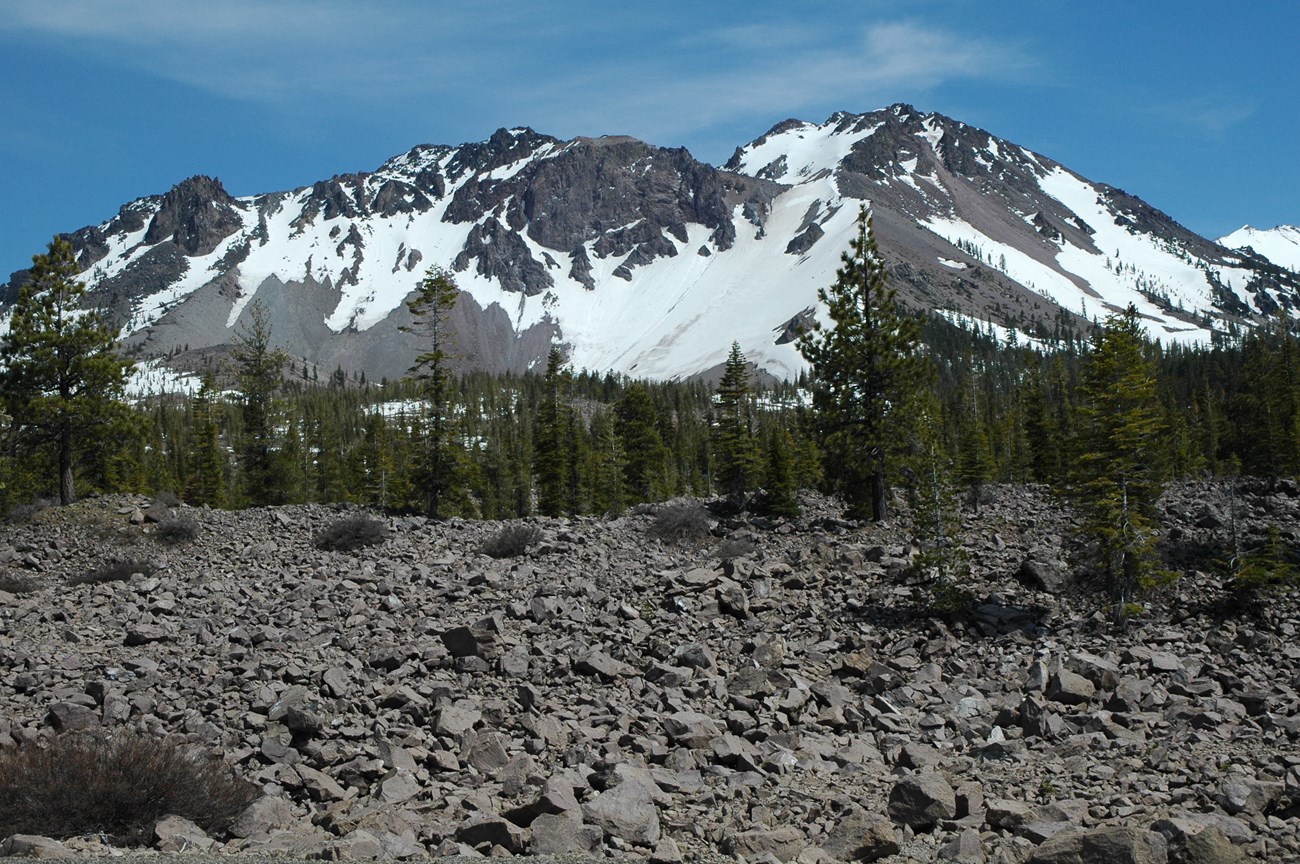
The Klamath Inventory & Monitoring Network (KLMN) consists of six national park units in northern California and southwestern Oregon. The parks include Crater Lake National Park (CRLA), Lassen Volcanic National Park (LAVO), Lava Beds National Monument (LABE), Oregon Caves National Monument (ORCA), Redwood National and State Parks (REDW) and Whiskeytown National Recreation Area (WHIS). Elevations within the network range from sea level at REDW to 3,187 m (10,456 ft) above sea level at LAVO. The following paragraphs are summarized from Santucci and Kenworthy (2009).Sarr et al. (2007) divided the Klamath region into two subregions with fundamentally different geological character. An approximate boundary from Redding to Yreka, California and from Ashland to Roseburg, Oregon can be used to separate the complex and varied Klamath–Coastal subregion from the volcanic Cascades–Modoc subregion.
The Klamath–Coastal subregion, including REDW, ORCA, and WHIS, is notable for its rugged, non-volcanic topography and complex geology. The Klamath Mountains are a classic example of a mountain belt formed from repeated accretion and compression of island arc terranes, oceanic crust, and upper mantle material. This accretion occurred during the last 150 million years along an active convergent continental margin on the westward edge of North America (Norris and Webb 1990). The Klamath Mountains province has been divided into four arc-shaped belts of rock of varying age that include (from east to west) the Eastern Klamath, central metamorphic, western Paleozoic and Triassic, and western Jurassic belts (Snoke and Barnes 2006). The Middle Jurassic (about 160 million years ago) was characterized by many igneous intrusions and metamorphism (see Geologic Time Scale).
The Cascades–Modoc subregion formed during relatively recent volcanism. The Cascades Range is a classic example of subduction zone volcanism where oceanic crust is forced beneath less dense continental crust. As the oceanic crust descends into the mantle, it is heated by surrounding rocks which force water-bearing minerals to break down. This water lowers the melting temperature of the surrounding rocks so that they partially melt. This buoyant molten material rises toward the surface, fueling volcanoes. The volcanic features of the Cascades within the KLMN include Crater Lake (CRLA) and the numerous volcanoes that form the Lassen volcanic center (LAVO). Crater Lake, a spectacular 8 x 10 km (5 x 6 mi) caldera, formed in a major eruption about 7,700 years ago from the collapse of a complex of overlapping shield and stratovolcanoes known as Mount Mazama. Lassen Peak represents the southernmost extent of the Cascades Range. A 1914–1917 explosive eruption there inspired its designation as a national park.
East of the Cascades, volcanism formed the Modoc Plateau, which is comprised of Miocene volcanic arc rocks (6–12 million years old) that formed when the axis of the Cascade arc was farther east. These Miocene volcanic units have been progressively buried by basalt lava flows related to volcanism in the Basin and Range Province (M. Clynne, U.S. Geological Survey, pers. comm., 2021). LABE, in the northern flank of Medicine Lake shield volcano, contains hundreds of lava-tube caves displaying a variety of spectacular lava-flow features (Waters et al. 1990; Venzke et al. 2002). Volcanic rocks from the Cascades represent the full compositional spectrum from basalt (~47% silica) to andesite to dacite to rhyolite (~77% silica) (Norris and Webb 1990). Some of the largest rhyolitic lava flows in the Cascades are just outside LAVO and at Medicine Lake. The eastern edge of the Cascades is bordered by the Modoc Plateau basalt flows. Continued volcanism in the eastern Cascades created geomorphic and geothermal features, including cinder cones, small shield volcanoes, lava tubes, and hot springs.
A Brief Geologic History
A few examples of events and Network resources in each geologic time period are highlighted below, from youngest to oldest.
Upper Miocene–lower Pliocene sedimentary units are represented by the Wimer Formation, St. George Formation, and Prairie Creek Formation at REDW. Upper Pliocene–Holocene volcanic flows are mapped at LAVO and are in association with alluvial, colluvial, glacial, and lacustrine deposits in the park.
Pleistocene units are widespread in the parks of the KLMN. At CRLA, sequences of extrusive volcanic rocks, including those associated with the eruption of Mount Mazama, are associated with Pleistocene–Holocene glacial and lacustrine deposits. Extensive volcanic flows of the Medicine Lake Volcanics at LABE are associated with some glacial and lacustrine units. The Battery and Falor Formations are Pleistocene units mapped at REDW.
The oldest Mesozoic rocks in the KLMN occur at ORCA and are represented by the Triassic Rattlesnake Creek Terrane marble and other metamorphic rocks. The Grayback Pluton, an Upper Jurassic pluton, is also mapped at ORCA. The Middle Jurassic–Upper Cretaceous Franciscan Complex is mapped at REDW. Additionally, the Upper Jurassic–Lower Cretaceous Shasta Bally Batholith occurs at WHIS.
The only park within the KLMN that has Paleozoic strata is WHIS. Lower–Middle Devonian through Mississippian rocks within WHIS include metavolcanic rocks of the Copley Greenstone, extrusive igneous rocks of the Balaklala Rhyolite, the Mule Mountain Stock, and the Bragdon Formation of sedimentary origin.
Precambrian rocks are not mapped within the parks of the KLMN.
Geology & Soils—Klamath Network Parks
Type Sections—Klamath Network Index

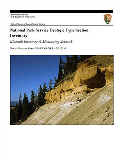
The geologic history above is excerpted from a report titled, "National Park Service geologic type section inventory: Klamath Inventory & Monitoring Network". Type sections are essential reference locations for the geoscientists who study geologic history and paleontology. A summary of the type sections in each park can be found at the links below.
-
Crater Lake National Park, Oregon (contains two identified stratotypes)
-
Lassen Volcanic National Park, California (no designated stratotypes identified)
-
Lava Beds National Monument, California (no designated stratotypes identified)
-
Oregon Caves National Monument & Preserve, Oregon (no designated stratotypes identified)
-
Redwood National Park and State Parks, California (contains one identified stratotype)
-
Whiskeytown National Recreation Area, California (no designated stratotypes identified)
The full Network report is available in digital format from:
Please cite this publication as:
-
Henderson T, Santucci VL, Connors T, Tweet JS. 2021. National Park Service geologic type section inventory: Klamath Inventory & Monitoring Network. Natural Resource Report. NPS/KLMN/NRR—2021/2286. National Park Service. Fort Collins, Colorado.
NPS Stratotype Inventory
Fossil Resources—Klamath Network

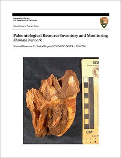
Between 2002 and 2011, network-based paleontological resource inventories were completed for all the 32 I&M networks, and six of the earliest were completely updated between 2012 and 2016. The report linked below summarizes the paleontological resources of all park units in the Klamath Inventory & Monitoring Network (KLMN). The report provides geologic background and paleontological resource data for each park to support management operations, planning, and science-based decision making as required by NPS management policies and the Paleontological Resources Preservation Act (2009).
The full report is available in digital format from
Please cite this publication as:
-
Santucci, V. L., and J. P. Kenworthy. 2009. Paleontological resource inventory and monitoring—Klamath Network. Natural Resource Technical Report NPS/NRPC/NRTR—2009/208. National Park Service, Fort Collins, Colorado.
Geodiversity Atlas pages—by Inventory & Monitoring Network
Arctic Network Index
Central Alaska Network Index
Chihuahuan Desert Network Index
Cumberland Piedmont Network Index
Eastern Rivers and Mountains Network Index
Great Lakes Network Index
Greater Yellowstone Network Index
Gulf Coast Network Index
Heartland Network Index
Klamath Network Index
Mediterranean Coast Network Index
Mid-Atlantic Network Index
Mojave Desert Network Index
National Capital Network Index
North Coast and Cascades Network Index
Northeast Coastal and Barrier Network Index
Northeast Temperate Network Index
Northern Colorado Plateau Network Index
Northern Great Plains Network Index
Pacific Islands Network Index
Rocky Mountain Network Index
San Francisco Bay Area Network Index
Sierra Nevada Network Index
Sonoran Desert Network Index
South Florida/Caribbean Network Index
Southeast Alaska Network Index
Southeast Coast Network Index
Southern Colorado Plateau Network Index
Southern Plains Network Index
Southwest Alaska Network Index
Upper Columbia Basin Network Index
Geodiversity Atlas pages—by State, U.S. Commonwealth, and Territories
Alabama | Alaska | Arizona | Arkansas | California | Colorado | Connecticut | District of Columbia | Delaware | Florida | Georgia | Hawaii | Idaho | Illinois | Indiana | Iowa | Kansas | Kentucky | Louisiana | Maine | Maryland | Massachusetts | Michigan | Minnesota | Mississippi | Missouri | Montana | Nebraska | Nevada | New Hampshire | New Jersey | New Mexico | New York | North Carolina | North Dakota | Ohio | Oklahoma | Oregon | Pennsylvania | Rhode Island | South Carolina | South Dakota | Tennessee | Texas | Utah | Vermont | Virginia | Washington | West Virginia | Wisconsin | Wyoming
U.S. Commonwealth and Territories
Region 2: South Atlantic-Gulf (Includes Puerto Rico and the U.S. Virgin Islands)
Region 3: Great Lakes
Region 4: Mississippi Basin
Region 5: Missouri Basin
Region 6: Arkansas-Rio Grande-Texas-Gulf
Region 7: Upper Colorado Basin
Region 8: Lower Colorado Basin
Region 9: Columbia-Pacific Northwest
Region 10: California-Great Basin
Region 11: Alaska
Region 12: Pacific Islands (American Samoa, Hawaii. Guam, Commonwealth of the Northern Mariana Islands)
Last updated: February 21, 2025
