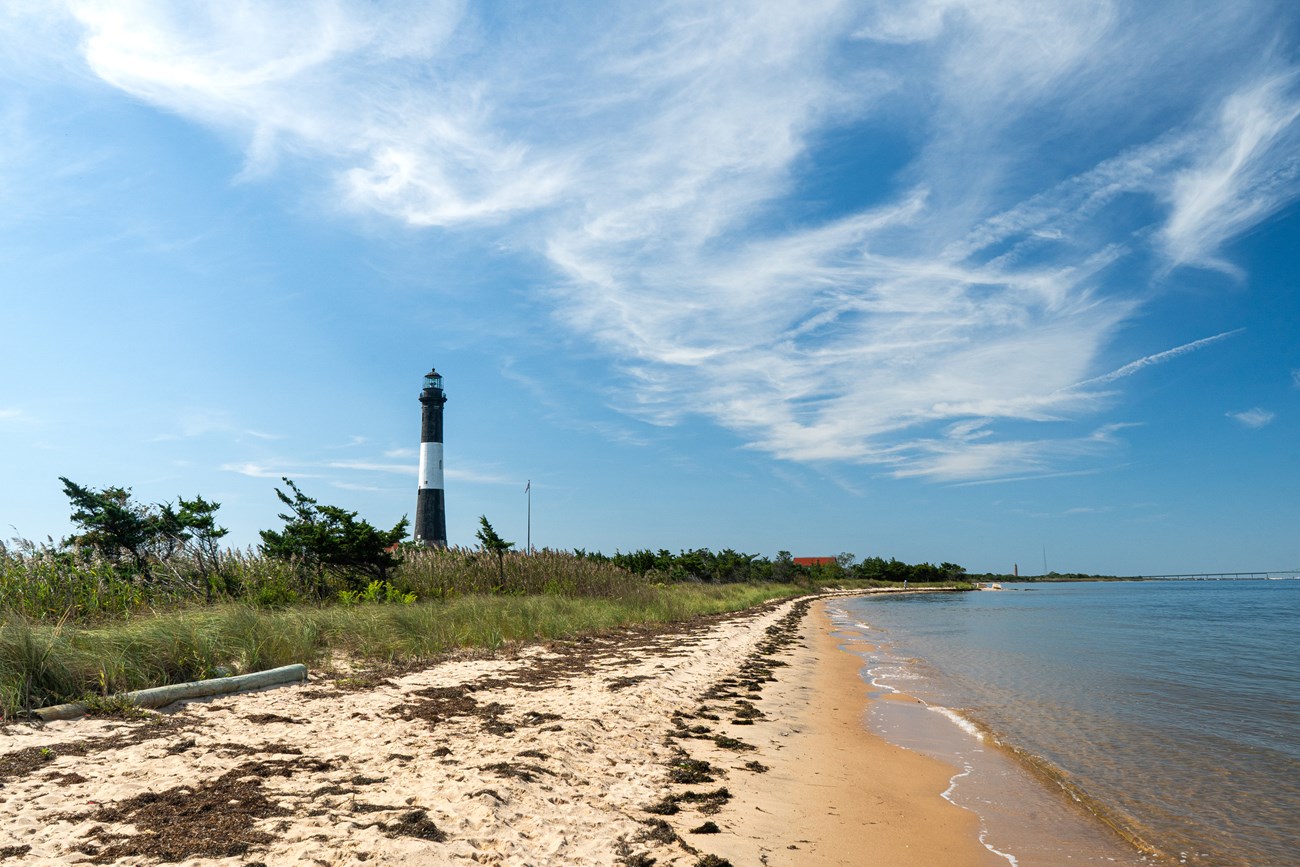
NPS photo by Tyler Kuliberda.
Geology and Stratigraphy of the Northeast Coastal and Barrier I&M Network
The Northeast Coastal and Barrier Inventory & Monitoring Network (NCBN) consists of eight national park units along the eastern coast of Maryland, Massachusetts, New Jersey, New York, and Virginia. Assateague Island National Seashore (ASIS), Cape Cod National Seashore (CACO), Colonial National Historical Park (COLO), Fire Island National Seashore (FIIS), Gateway National Recreation Area (GATE), George Washington Birthplace National Monument (GEWA), Sagamore Hill National Historic Site (SAHI), and Thomas Stone National Historic Site (THST) span the northeast and mid-Atlantic Coastal Plain from Massachusetts in the north, to Virginia in the south. The geographic distribution and low elevations of the NCBN parks along the Atlantic Ocean place the network parks in the path of Atlantic storms and hurricanes, especially resources associated with the barrier islands and seashores (for more on resources, see Coastal Geology). Geologically, the NCBN are largely represented by surficial deposits with limited exposures of Cenozoic bedrock. Consequently, only one geologic type section is identified for the parks of the NCBN.
A Brief Geologic History
A few examples of events and Network resources in each geologic time period are highlighted below, from youngest to oldest.
The oldest Cenozoic unit exposed within the NCBN is the early Eocene Nanjemoy Formation, a shallow marine deposit exposed in THST. The early–middle Miocene Calvert Formation is exposed in several of the mid-Atlantic parks including GATE, GEWA and THST. The late Miocene Eastover Formation, a shallow marine unit, is exposed in COLO. The Pliocene Yorktown and Cold Harbor Formations are also exposed at COLO.
In the NCBN, several Pleistocene map units in Virginia’s Coastal Plain are referred to as alloformations, defined as sedimentary sequences bound by unconformities resulting from erosion during sea level lowstand and deposition within drainages during marine transgressions (sea level rise). Alloformations typically have a gravelly or coarse base possibly overlain by marsh or swamp sediments, overlain by sand and clay (R. Berquist, William & Mary University, pers. comm., 2021). Alloformations and formations may be used or understood as lithologic map units similarly.
Surficial Quaternary and Holocene units occur in most of the NCBN parks. However, most of these units are not formally named. A few named Pleistocene formations or alloformations are mapped in several parks, including the Bacons Castle Formation, Windsor Formation, Charles City Alloformation, Chuckatuck Alloformation, Shirley Alloformation, Elsing Green Alloformation, and Tabb Alloformation at COLO and late Pleistocene Tabb Alloformation at GEWA. The late Pleistocene Sinepuxent Formation occurs in the subsurface at ASIS.
No Mesozoic rocks are exposed at the surface within any of the NCBN parks. Late Cretaceous coastal sediments are mapped subsurface (Raritan Formation) at SAHI.
No Paleozoic rocks are exposed at the surface within any of the NCBN parks.
No Precambrian rocks are exposed at the surface within any of the NCBN parks.
Geology & Soils—Northeast Coastal and Barrier Network Parks
Type Sections—Northeast Coastal and Barrier Network

The geologic history above is excerpted from a report titled, "National Park Service geologic type section inventory: Northeast Coastal and Barrier Inventory & Monitoring Network". Type sections are essential reference locations for the geoscientists who study geologic history and paleontology. A summary of the type sections in each park can be found at the links below.
-
Assateague Island National Seashore, Maryland and Virginia (no designated stratotypes identified)
-
Cape Cod National Seashore, Massachusetts (no designated stratotypes identified)
-
Colonial National Historical Park, Virginia (contains one identified stratotype)
-
Fire Island National Seashore, New York (no designated stratotypes identified)
-
Gateway National Recreation Area, New Jersey and New York (no designated stratotypes identified)
-
George Washington Birthplace National Monument, Virginia (no designated stratotypes identified)
-
Sagamore Hill National Historic Site, New York (no designated stratotypes identified)
-
Thomas Stone National Historic Site, Maryland (no designated stratotypes identified)
The full Network report is available in digital format from:
Please cite this publication as:
-
Henderson T, Santucci VL, Connors T, Tweet JS. 2021. National Park Service geologic type section inventory: Northeast Coastal and Barrier Inventory & Monitoring Network. Natural Resource Report. NPS/NCBN/NRR—2021/2287. National Park Service. Fort Collins, Colorado.
NPS Stratotype Inventory
Fossil Resources—Northeast Coastal and Barrier Network

Between 2002 and 2011, network-based paleontological resource inventories were completed for all the 32 I&M networks, and six of the earliest were completely updated between 2012 and 2016. The report linked below summarizes the paleontological resources of all park units in the Northeast Coastal and Barrier Inventory & Monitoring Network (NCBN). The report provides geologic background and paleontological resource data for each park to support management operations, planning, and science-based decision making as required by NPS management policies and the Paleontological Resources Preservation Act (2009).
The full report is available in digital format from
-
DataStore - Paleontological resource inventory and monitoring: Northeast Coastal and Barrier Network (nps.gov)
Please cite this publication as:
-
Tweet JS, Santucci VL, Connors T. 2014. Paleontological resource inventory and monitoring: Northeast Coastal and Barrier Network. Natural Resource Technical Report. NPS/NCBN/NRTR—2014/897. National Park Service. Fort Collins, Colorado.
Geodiversity Atlas pages—by Inventory & Monitoring Network
Arctic Network Index
Central Alaska Network Index
Chihuahuan Desert Network Index
Cumberland Piedmont Network Index
Eastern Rivers and Mountains Network Index
Great Lakes Network Index
Greater Yellowstone Network Index
Gulf Coast Network Index
Heartland Network Index
Klamath Network Index
Mediterranean Coast Network Index
Mid-Atlantic Network Index
Mojave Desert Network Index
National Capital Network Index
North Coast and Cascades Network Index
Northeast Coastal and Barrier Network Index
Northeast Temperate Network Index
Northern Colorado Plateau Network Index
Northern Great Plains Network Index
Pacific Islands Network Index
Rocky Mountain Network Index
San Francisco Bay Area Network Index
Sierra Nevada Network Index
Sonoran Desert Network Index
South Florida/Caribbean Network Index
Southeast Alaska Network Index
Southeast Coast Network Index
Southern Colorado Plateau Network Index
Southern Plains Network Index
Southwest Alaska Network Index
Upper Columbia Basin Network Index
Geodiversity Atlas pages—by State, U.S. Commonwealth, and Territories
Alabama | Alaska | Arizona | Arkansas | California | Colorado | Connecticut | District of Columbia | Delaware | Florida | Georgia | Hawaii | Idaho | Illinois | Indiana | Iowa | Kansas | Kentucky | Louisiana | Maine | Maryland | Massachusetts | Michigan | Minnesota | Mississippi | Missouri | Montana | Nebraska | Nevada | New Hampshire | New Jersey | New Mexico | New York | North Carolina | North Dakota | Ohio | Oklahoma | Oregon | Pennsylvania | Rhode Island | South Carolina | South Dakota | Tennessee | Texas | Utah | Vermont | Virginia | Washington | West Virginia | Wisconsin | Wyoming
U.S. Commonwealth and Territories
Region 2: South Atlantic-Gulf (Includes Puerto Rico and the U.S. Virgin Islands)
Region 3: Great Lakes
Region 4: Mississippi Basin
Region 5: Missouri Basin
Region 6: Arkansas-Rio Grande-Texas-Gulf
Region 7: Upper Colorado Basin
Region 8: Lower Colorado Basin
Region 9: Columbia-Pacific Northwest
Region 10: California-Great Basin
Region 11: Alaska
Region 12: Pacific Islands (American Samoa, Hawaii. Guam, Commonwealth of the Northern Mariana Islands)
Last updated: February 21, 2025
