NPS image.
Geology and Stratigraphy of the Southeast Coast I&M Network Parks
The Southeast Coast Inventory & Monitoring Network (SECN) consists of 20 national park units in Alabama, Florida, Georgia, South Carolina, and North Carolina. These park units include Canaveral National Seashore (CANA), Cape Hatteras National Seashore (CAHA), Cape Lookout National Seashore (CALO), Castillo de San Marcos National Monument (CASA), Charles Pinckney National Historic Site (CHPI), Chattahoochee River National Recreation Area (CHAT), Congaree National Park (CONG), Cumberland Island National Seashore (CUIS), Fort Caroline National Memorial (FOCA), Fort Frederica National Monument (FOFR), Fort Matanzas National Monument (FOMA), Fort Pulaski National Monument (FOPU), Fort Raleigh National Historic Site (FORA), Fort Sumter and Fort Moultrie National Historical Park (FOSU), Horseshoe Bend National Military Park (HOBE), Kennesaw Mountain National Battlefield Park (KEMO), Moores Creek National Battlefield (MOCR), Ocmulgee Mounds National Historical Park (OCMU), Timucuan Ecological and Historic Preserve (TIMU), and Wright Brothers National Memorial (WRBR). 17 of these are identified as having significant natural resources. The parks that comprise the SECN protect a combined 100,064 hectares (247,265 acres) and vary in size from 8 hectares (19 acres) in CASA to 23,335 hectares (57,662 acres) in CANA. Resources protected by SECN park units range include prehistoric sites, military installations dating from the late 16th century to the Civil War, and important ecological settings consisting of beaches, barrier islands, coastal wetlands, river valleys, and bottomland hardwood forests.
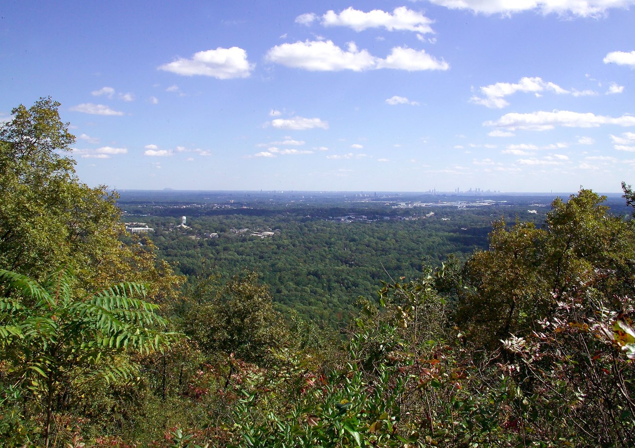
The Southeast Coast Network occupies two geologically distinct physiographic provinces that include the Piedmont and the Atlantic Coastal Plain. The Piedmont province is characterized by highly complex, metamorphic and igneous rocks that form low, rolling hills. The southern portion of the Piedmont province contains CHAT, HOBE, and KEMO. The Atlantic Coastal Plain predominantly consists of relatively flat, gently sloping topography composed of unconsolidated and reworked sedimentary rocks. These sedimentary rocks date from the Mesozoic to the present and form a wedge-shaped sequence that thickens toward the Atlantic coast (see also geologic time scale). The majority of SECN parks occupy the Atlantic Coastal Plain (CAHA, CALO, CANA, CASA, CONG, CUIS, FOCA, FOFR, FOMA, FOPU, FOSU, MOCR, OCMU, and TIMU). The “Fall Line” or “Fall Zone” marks a transitional zone between the older, more resistant crystalline rocks of the Piedmont with the younger, less consolidated sedimentary rocks of the Atlantic Coastal Plain to the east.
The geology of the SECN records a long history of continental assembly culminating in the formation of the supercontinent Pangea, followed by rifting and the development of the modern passive margin of North America. Many of the SECN parks protect coastal regions of the Atlantic Coastal Plain and consist of geologically young, Quaternary-age deposits that were shed from the Appalachian Mountains toward the east. Parks such as OCMU that are situated near the inner edge of the Atlantic Coastal Plain contain older sedimentary deposits that range from the Cretaceous to the Eocene. The geology of the Piedmont parks (CHAT, HOBE, and KEMO) represent the oldest rocks of the SECN and date back to the Precambrian and Paleozoic. These ancient strata are more structurally complex, recording various periods of deformation associated with the formation of the Appalachian Mountains during the Paleozoic.
A Brief Geologic History—Appalachian Highlands Network
A few examples of events and Network resources in each geologic time period are highlighted below, from youngest to oldest.
The Cenozoic is widely represented by the park units of the SECN, with some of the oldest rocks including the Eocene Ocala Limestone and Barwell Formation in OCMU. Additional formally named units include the Pleistocene Anastasia Formation in CANA and FOMA, and the Pleistocene Socastee Formation in MOCR.
A large constituent of SECN geology consists of surface deposits derived from marine (CAHA, CALO, CANA, CASA, CUIS, FOCA, FOFR, FOMA, FOPU, FOSU, MOCR, and TIMU) or river (CONG and OCMU) deposition during the Pleistocene and Holocene (2.58 Ma to the present). In particular, park units situated along the coast (CAHA, CALO, CANA, CASA, CUIS, FOCA, FOFR, FOMA, FOPU, FOSU, and TIMU) contain Quaternary-age geomorphological units that represent barrier island settings and include beach, dune, marsh, lagoon, and tidal channel deposits.
Rocks of the Mesozoic Era are only found in OCMU and consist of the Cretaceous Ripley Formation.
Similar to the occurrence of Precambrian strata, the Paleozoic Era is represented in CHAT, HOBE, and KEMO. Formations mapped across multiple park units include the Neoproterozoic–Ordovician(?) Ropes Creek Metabasalt, Crider Gneiss, and Stonewall Gneiss in CHAT and KEMO. Precambrian to Paleozoic-age strata of the Jacksons Gap Group underlie HOBE. Informally named Neoproterozoic–Ordovician(?)-age units include garnet-rich schist in CHAT, as well as the migmatite of Kennesaw Mountain, weathered amphibolite, and altered ultramafic rock in KEMO.
The Cambrian Period is represented by strata of the Sandy Springs Group (including the Chattahoochee Palisades Quartzite and an informal aluminous schist unit) in CHAT, in addition to the Crawfish Creek Formation in KEMO. Rocks of the Ordovician include the Emuckfaw Group and Kowaliga Gneiss that are mapped in HOBE.
Several informal Paleozoic-age units exist in the SECN and include the Cambrian–Ordovician schist of Hulett facies in KEMO; Ordovician–Permian(?) Garnet Hill-type altered rocks in KEMO; Ordovician–Permian(?) button schist in CHAT; and Silurian–Permian(?) mylonitized granitoid rocks in CHAT.
Precambrian-age rocks found within the Southeast Coast Network include igneous and metamorphic rocks in CHAT, HOBE, and KEMO. Some of the oldest rocks in the SECN underlie CHAT and consist of the Mesoproterozoic–Permian(?) Long Island Creek Gneiss. Strata of the Neoproterozoic– Ordovician(?) Ropes Creek Metabasalt, Crider Gneiss, and Stonewall Gneiss are mapped in both CHAT and KEMO. Additional Precambrian to Paleozoic-age rocks associated with the Jacksons Gap Group underlie HOBE. Several informally named Neoproterozoic–Ordovician(?)-age units exist in SECN and include garnet-rich schist in CHAT, as well as the migmatite of Kennesaw Mountain, weathered amphibolite, and altered ultramafic rock in KEMO.
Geology & Soils—Southeast Coast Network Parks
Type Sections—Southeast Coast Network

The geologic history above is excerpted from a report titled, "National Park Service geologic type section inventory: Southeast Coast Inventory & Monitoring Network". Type sections are essential reference locations for the geoscientists who study geologic history and paleontology. A summary of the type sections in each park can be found at the links below.
-
Cape Hatteras National Seashore, North Carolina (no designated stratotypes identified)
-
Cape Lookout National Seashore, North Carolina (no designated stratotypes identified)
-
Canaveral National Seashore, Tennessee and North Carolina (no designated stratotypes identified)
-
Castillo De San Marcos National Monument, Florida (no designated stratotypes identified)
-
Chattahoochee River National Recreation Area, Georgia (contains two identified stratotypes)
-
Congaree National Park, South Carolina (no designated stratotypes identified)
-
Cumberland Island National Seashore, Georgia (no designated stratotypes identified)
-
Fort Frederica National Monument, Georgia (no designated stratotypes identified)
-
Fort Matanzas National Monument, Florida (no designated stratotypes identified)
-
Fort Pulaski National Monument, Georgia (no designated stratotypes identified)
-
Fort Sumter and Fort Moultrie National Historical Park, South Carolina (no designated stratotypes identified)
-
Horseshoe Bend National Military Park, Alabama (no designated stratotypes identified)
-
Kennesaw Mountain National Battlefield Park, Georgia (no designated stratotypes identified)
-
Moores Creek National Battlefield, North Carolina (no designated stratotypes identified)
-
Ocmulgee Mounds National Historical Park, Georgia (no designated stratotypes identified)
-
Timucuan Ecological and Historic Preserve and Fort Caroline National Memorial, Florida (no designated stratotypes identified)
The full Network report is available in digital format from:
Please cite this publication as:
-
Henderson TC, Santucci VL, Connors T, Tweet JS. 2022. National Park Service geologic type section inventory: Southeast Coast Inventory & Monitoring Network. Natural Resource Report. NPS/SECN/NRR—2022/2429. National Park Service. Fort Collins, Colorado.
NPS Stratotype Inventory
Fossil Resources—Southeast Coast Network

Between 2002 and 2011, network-based paleontological resource inventories were completed for all the 32 I&M networks, and six of the earliest were completely updated between 2012 and 2016. The report linked below summarizes the paleontological resources of all park units in the Southeast Coast Inventory & Monitoring Network (SECN). The report provides geologic background and paleontological resource data for each park to support management operations, planning, and science-based decision making as required by NPS management policies and the Paleontological Resources Preservation Act (2009).
The full report is available in digital format from
Please cite this publication as:
-
Tweet JS, Santucci VL, Kenworthy JP. 2009. Paleontological Resource Inventory and Monitoring: Southeast Coast Network. Natural Resource Technical Report. Natural Resource Technical Report NPS/NRPC/NRTR—2009/197. National Park Service. Fort Collins, Colorado.
Geodiversity Atlas pages—by Inventory & Monitoring Network
Arctic Network Index
Central Alaska Network Index
Chihuahuan Desert Network Index
Cumberland Piedmont Network Index
Eastern Rivers and Mountains Network Index
Great Lakes Network Index
Greater Yellowstone Network Index
Gulf Coast Network Index
Heartland Network Index
Klamath Network Index
Mediterranean Coast Network Index
Mid-Atlantic Network Index
Mojave Desert Network Index
National Capital Network Index
North Coast and Cascades Network Index
Northeast Coastal and Barrier Network Index
Northeast Temperate Network Index
Northern Colorado Plateau Network Index
Northern Great Plains Network Index
Pacific Islands Network Index
Rocky Mountain Network Index
San Francisco Bay Area Network Index
Sierra Nevada Network Index
Sonoran Desert Network Index
South Florida/Caribbean Network Index
Southeast Alaska Network Index
Southeast Coast Network Index
Southern Colorado Plateau Network Index
Southern Plains Network Index
Southwest Alaska Network Index
Upper Columbia Basin Network Index
Geodiversity Atlas pages—by State, U.S. Commonwealth, and Territories
Alabama | Alaska | Arizona | Arkansas | California | Colorado | Connecticut | District of Columbia | Delaware | Florida | Georgia | Hawaii | Idaho | Illinois | Indiana | Iowa | Kansas | Kentucky | Louisiana | Maine | Maryland | Massachusetts | Michigan | Minnesota | Mississippi | Missouri | Montana | Nebraska | Nevada | New Hampshire | New Jersey | New Mexico | New York | North Carolina | North Dakota | Ohio | Oklahoma | Oregon | Pennsylvania | Rhode Island | South Carolina | South Dakota | Tennessee | Texas | Utah | Vermont | Virginia | Washington | West Virginia | Wisconsin | Wyoming
U.S. Commonwealth and Territories
Region 2: South Atlantic-Gulf (Includes Puerto Rico and the U.S. Virgin Islands)
Region 3: Great Lakes
Region 4: Mississippi Basin
Region 5: Missouri Basin
Region 6: Arkansas-Rio Grande-Texas-Gulf
Region 7: Upper Colorado Basin
Region 8: Lower Colorado Basin
Region 9: Columbia-Pacific Northwest
Region 10: California-Great Basin
Region 11: Alaska
Region 12: Pacific Islands (American Samoa, Hawaii. Guam, Commonwealth of the Northern Mariana Islands)
Last updated: February 21, 2025
