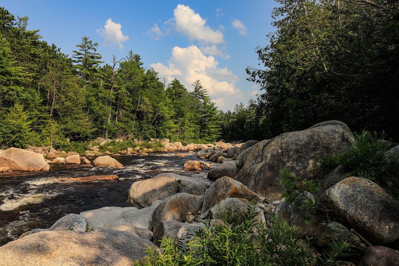
NPS photo by Alyssa Mattei.
Geology and Stratigraphy of the Northeast Temperate I&M Network
The Northeast Temperate Inventory & Monitoring Network (NETN) consists of 12 national park units in Connecticut, Maine, Massachusetts, New Hampshire, New Jersey, New York, and Vermont, plus the long-distance Appalachian National Scenic Trail (APPA). APPA traverses parts of Connecticut, Georgia, Maine, Maryland, Massachusetts, New Hampshire, New Jersey, New York, North Carolina, Pennsylvania, Tennessee, Vermont, Virginia, and West Virginia. The park units of the NETN include: Acadia National Park (ACAD); Appalachian National Scenic Trail (APPA); Boston Harbor Islands National Recreation Area (BOHA); Katahdin Woods and Waters National Monument (KAWW); Marsh-Billings-Rockefeller National Historical Park (MABI); Minute Man National Historical Park (MIMA); Morristown National Historical Park (MORR); Roosevelt-Vanderbilt Headquarters (ROVA) that consists of Eleanor Roosevelt National Historic Site (ELRO), Home of Franklin D. Roosevelt National Historic Site (HOFR), and Vanderbilt Mansion National Historic Site (VAMA); Saint-Gaudens National Historical Park (SAGA); Saratoga National Historical Park (SARA); Saugus Iron Works National Historic Site (SAIR); and Weir Farm National Historical Park (WEFA). The parks that comprise the NETN protect a combined 154,719 hectares (382,319 acres) of land and vary in size from 3 hectares (9 acres) in SAIR to 95,494 hectares (235,973 acres) in APPA.
The geologic history of the Northeast Temperate Network is complex, involving hundreds of millions of years of dynamic plate tectonic processes that include continental collisions (orogenies), igneous intrusions, metamorphism, folding, faulting, and rifting. Much of the bedrock of the NETN, especially the New England region, originated as foreign landmasses called terranes that were slowly accreted to the eastern margin of ancestral North America (Laurentia) throughout the Paleozoic Era. These various terranes represent large, fault-bounded masses of rock that are juxtaposed against bedrock of different age and lithology.
Collisional events culminating in the formation of the Appalachian Mountains would result in widespread metamorphism, folding, faulting, uplift, and the emplacement of igneous intrusions such as Cadillac Mountain Plutonic-Volcanic Complex and Cranberry Island Series at ACAD. The Appalachian Mountains formed as the result of three major mountain-building events that include (from oldest to youngest) the Taconic, Acadian, and Alleghenian orogenies. The first major orogenic episode, known as the Taconic Orogeny, occurred during the Ordovician Period approximately 470– 450 Ma (Mega annum, million years ago) and involved the accretion of island arc material to eastern Laurentia (Gonzalez et al. 2018; Hildebrand and Whalen 2021). During the Devonian Period (410– 360 Ma), the Acadian Orogeny resulted in the collision of the Avalon terrane with Laurentia (Gibson et al. 2021). The Alleghenian Orogeny occurred throughout the Pennsylvanian and Permian Periods (325–260 Ma) and involved the collision between Gondwana (a large continent that included two-thirds of today’s continental area) and Laurentia that led to the formation of the supercontinent Pangea (Hillenbrand and Williams 2021). Many Paleozoic-age metamorphic units underlie the NETN and were directly influenced by regional-scale metamorphism associated with the assembly of Pangea.
Following the breakup of Pangea in the Triassic and Jurassic Periods, the east coast of North America developed into the modern passive margin. Erosional forces slowly weathered the Appalachian highlands, transporting immense amounts of sediment into the coastal and interior lowlands. Glacial activity throughout the Pleistocene Epoch (2.59 Ma to 12,000 years ago) sculpted much of the NETN landscape into its present form. During the most recent glacial periods (the Illinoian and Wisconsinan), ice advanced as far south as northern New Jersey, beveling the landscape and leaving behind unconsolidated rock debris called drift (glacial till, another term frequently encountered, is a subtype of drift referring to material dropped directly by glaciers without being reworked by flowing water, but is sometimes used interchangeably with drift). In regions associated with topographic depressions, large amounts of drift and meltwater produced trapped glacial lakes that persisted for hundreds to thousands of years. Some of these glacial lakes and their related park units include Glacial Lake Albany (ROVA and SARA), Glacial Lake Bouvé (BOHA), Glacial Lake Hitchcock (MABI, SAGA, and SPAR), glacial lakes Concord and Sudbury (MIMA), and Glacial Lake Passaic (MORR). The glacial retreat also removed the immense weight of the ice, causing coastal areas such as ACAD, BOHA, and SAIR to rise in elevation in a process known as isostatic rebound. Coastal regions of these parks were once temporarily below sea level but are now exposed in the form of glacial marine terraces.
A Brief Geologic History
A few examples of events and Network resources in each geologic time period are highlighted below, from youngest to oldest.
Cenozoic units are present in many of the NETN parks and a product of dynamic glacial and fluvial erosion. The only formally named unit is the Pleistocene Presumpscot Formation that occurs in ACAD. Other units include unconsolidated, Quaternary-age glacial till deposits (ACAD, BOHA, MABI, MIMA, ROVA, SARA, WEFA), drumlins (BOHA), glacio-fluvial deposits (BOHA), and glacial stratified deposits (MIMA). Pleistocene-age strata include marine shoreline and esker deposits (ACAD), as well as glacial lake clay and sand deposits (SARA). More recent Holocene-age units include deposits associated with swamp, tidal marsh, and freshwater wetland environments (ACAD), fluvial terraces (MABI, SARA), and alluvium (MABI, MIMA).
Mesozoic rocks are rare in the park units of the NETN, only represented by sedimentary rocks of the Jurassic Boonton Formation mapped on the eastern side of the Ramapo Fault in MORR.
Paleozoic strata are found in all park units of the NETN except MORR and SAIR. The bedrock geology of ACAD spans from the Cambrian through the Devonian and includes the Cambrian– Ordovician Ellsworth Schist, Silurian–Devonian Bar Harbor Formation, and similar-age tuffs and felsite flows of the Cranberry Volcanic Series. Silurian–Devonian-age units associated with the Cadillac Mountain Plutonic-Volcanic Complex dominate the bedrock of ACAD.
The Paleozoic strata of BOHA includes the Neoproterozoic–Cambrian(?) Boston Bay Group and unnamed doleritic sills and dikes that span from the Proterozoic to the Jurassic. A rich assemblage of Paleozoic strata occurs in KAWW, with the oldest rocks consisting of the Cambrian Grand Pitch Formation. Ordovician-age units within KAWW include the Wassataquoik Chert, as well as informal volcanic rocks and conglomerate. Plutonic rocks of the Ordovician–Silurian Rockabema Quartz Diorite occur in northern KAWW. Silurian-age units in KAWW include the Allsbury Formation 14 along the eastern park boundary, as well as informal conglomerate, tuff breccia, and limestone units. The Devonian Katahdin Granite, Traveler Rhyolite, Seboomook Formation, and Matagamon Sandstone underlie much of western KAWW.
The bedrock of MABI and SAGA are both composed of the Silurian–Devonian Waits River Formation and Devonian Gile Mountain Formation. A portion of MABI includes the Silurian Standing Pond Volcanics. Underlying MIMA are several Paleozoic-age igneous and metamorphic rocks such as the Neoproterozoic–Silurian Fiske Hill Granite, Cambrian–Ordovician Nashoba Formation and Marlboro Formation, Silurian Sudbury Granite, as well as the Silurian–Devonian Assabet Quartz Diorite and Andover Granite.
The Ordovician Austin Glen Formation and Stuyvesant Falls Formation both occur in the park units of ROVA. Similar-age sedimentary strata of the Mohawk River Zone, Stillwater Shale Zone, and Rocky Tucks Zone underlie SARA. The bedrock geology of WEFA consists entirely of the Ordovician Harrison gneiss and an unnamed granitic gneiss unit.
Ancient Precambrian rocks are found in four park units of the NETN, with some of the oldest bedrock represented by Mesoproterozoic-age granitic rocks of the Byram Intrusive Suite and similarly ancient metamorphic units of the Losee Metamorphic Suite in MORR. Strata associated with the Neoproterozoic–Cambrian(?) Boston Bay Group (Roxbury Conglomerate and Cambridge Argillite) underlie BOHA, in addition to unnamed Proterozoic-age igneous rocks and Proterozoic-Jurassic doleritic sills and dikes. The Neoproterozoic–Silurian Fiske Hill Granite occurs in the Battle Road Unit of MIMA on the eastern side of the Burlington Mylonite Zone-Bloody Bluff Fault. The bedrock of SAIR is composed entirely of rhyolite flows, welded-ash flows, tuffs, and breccias of the Neoproterozoic Lynn Volcanics, with a minor portion of the park underlain by unnamed Proterozoic-age granitoid rocks.
Geology & Soils—Northeast Temperate Network Parks
Type Sections—Northeast Temperate Network

The geologic history above is excerpted from a report titled, "National Park Service geologic type section inventory: Northeast Temperate Inventory & Monitoring Network". Type sections are essential reference locations for the geoscientists who study geologic history and paleontology. A summary of the type sections in each park can be found at the links below.
-
Acadia National Park, Maine (contains one identified stratotype)
-
Appalachian National Scenic Trail, Connecticut, Georgia, Maine, Maryland, Massachusetts, New Hampshire, New
Jersey, New York, North Carolina, Pennsylvania, Tennessee, Vermont, Virginia, and West Virginia (contains or is in very close proximity to 27 identified stratotypes) -
Boston Harbor Islands National Recreation Area, Massachusetts (no designated stratotypes identified)
-
Katahdin Woods and Waters National Monument, Maine (contains three identified stratotypes)
-
Marsh-Billings-Rockefeller National Historical Park, Vermont (no designated stratotypes identified)
-
Minute Man National Historical Park, Massachusetts (no designated stratotypes identified)
-
Morristown National Historical Park, New Jersey (no designated stratotypes identified)
-
Roosevelt-Vanderbilt Headquarters, New York (no designated stratotypes identified)
-
Saint-Gaudens National Historical Park, New Hampshire (no designated stratotypes identified)
-
Saratoga National Historical Park, New York (no designated stratotypes identified)
-
Saugus Iron Works National Historic Site, Massachusetts (no designated stratotypes identified)
-
Weir Farm National Historical Park, Connecticut (no designated stratotypes identified)
The full Network report is available in digital format from:
Please cite this publication as:
-
Henderson TC, Santucci VL, Connors T, Tweet JS. 2022. National Park Service geologic type section inventory: Northeast Temperate Inventory & Monitoring Network. Natural Resource Report. NPS/NETN/NRR—2022/2475. National Park Service. Fort Collins, Colorado.
NPS Stratotype Inventory
Fossil Resources—Northeast Temperate Network

Between 2002 and 2011, network-based paleontological resource inventories were completed for all the 32 I&M networks, and six of the earliest were completely updated between 2012 and 2016. The report linked below summarizes the paleontological resources of all park units in the Northeast Temperate Inventory & Monitoring Network (NETN). The report provides geologic background and paleontological resource data for each park to support management operations, planning, and science-based decision making as required by NPS management policies and the Paleontological Resources Preservation Act (2009).
The full report is available in digital format from
-
DataStore - Paleontological resource inventory and monitoring: Northeast Temperate Network (nps.gov)
Please cite this publication as:
-
Tweet JS, Santucci VL, Kenworthy JP. 2010. Paleontological resource inventory and monitoring: Northeast Temperate Network. Natural Resource Technical Report. NPS/NRPC/NRTR—2010/326. Natural Resource Program Center. Fort Collins, Colorado.
Geodiversity Atlas pages—by Inventory & Monitoring Network
Arctic Network Index
Central Alaska Network Index
Chihuahuan Desert Network Index
Cumberland Piedmont Network Index
Eastern Rivers and Mountains Network Index
Great Lakes Network Index
Greater Yellowstone Network Index
Gulf Coast Network Index
Heartland Network Index
Klamath Network Index
Mediterranean Coast Network Index
Mid-Atlantic Network Index
Mojave Desert Network Index
National Capital Network Index
North Coast and Cascades Network Index
Northeast Coastal and Barrier Network Index
Northeast Temperate Network Index
Northern Colorado Plateau Network Index
Northern Great Plains Network Index
Pacific Islands Network Index
Rocky Mountain Network Index
San Francisco Bay Area Network Index
Sierra Nevada Network Index
Sonoran Desert Network Index
South Florida/Caribbean Network Index
Southeast Alaska Network Index
Southeast Coast Network Index
Southern Colorado Plateau Network Index
Southern Plains Network Index
Southwest Alaska Network Index
Upper Columbia Basin Network Index
Geodiversity Atlas pages—by State, U.S. Commonwealth, and Territories
Alabama | Alaska | Arizona | Arkansas | California | Colorado | Connecticut | District of Columbia | Delaware | Florida | Georgia | Hawaii | Idaho | Illinois | Indiana | Iowa | Kansas | Kentucky | Louisiana | Maine | Maryland | Massachusetts | Michigan | Minnesota | Mississippi | Missouri | Montana | Nebraska | Nevada | New Hampshire | New Jersey | New Mexico | New York | North Carolina | North Dakota | Ohio | Oklahoma | Oregon | Pennsylvania | Rhode Island | South Carolina | South Dakota | Tennessee | Texas | Utah | Vermont | Virginia | Washington | West Virginia | Wisconsin | Wyoming
U.S. Commonwealth and Territories
Region 2: South Atlantic-Gulf (Includes Puerto Rico and the U.S. Virgin Islands)
Region 3: Great Lakes
Region 4: Mississippi Basin
Region 5: Missouri Basin
Region 6: Arkansas-Rio Grande-Texas-Gulf
Region 7: Upper Colorado Basin
Region 8: Lower Colorado Basin
Region 9: Columbia-Pacific Northwest
Region 10: California-Great Basin
Region 11: Alaska
Region 12: Pacific Islands (American Samoa, Hawaii. Guam, Commonwealth of the Northern Mariana Islands)
Last updated: February 21, 2025
